
Blog
•
2026 · 06 · 29
Case study
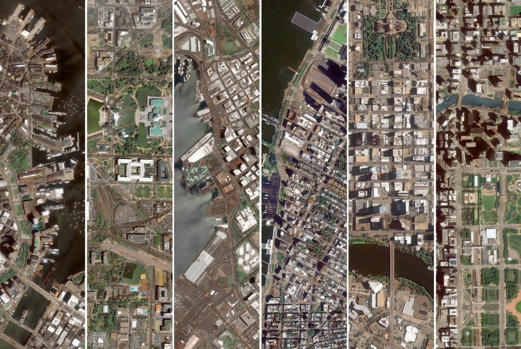
12 U.S. Cities From Space. A Satellite Perspective on America’s 250th.
The United States turns 250 in 2026. We mark it from Space. 12 American cities, from the dense urban core of New York to the remote capital of Alaska, seen from Space with GEOSAT VHR satellites. Each city is a different story, told through street grids, coastlines, building density, and spatial footprint. Satellite imagery tells […]
Read
Case study
2026 · 06 · 01
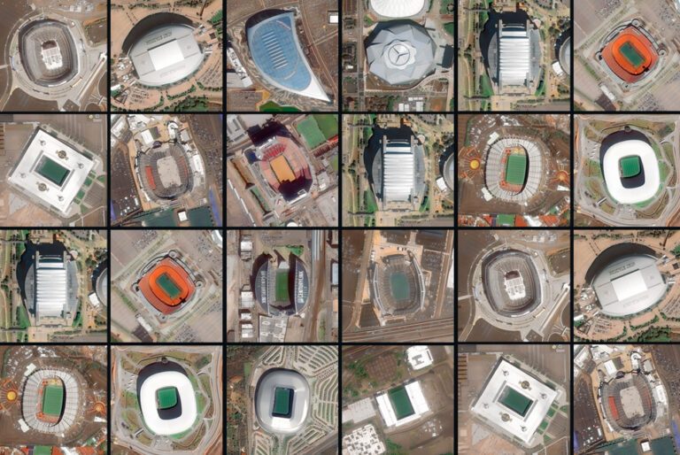
The 2026 World Cup Stadiums, Seen From Space.
Read

News
2026 · 05 · 18
Nouadhibou, the ship Graveyard that became one of Africa’s key Fishing Ports
Read
Case study
2026 · 04 · 20
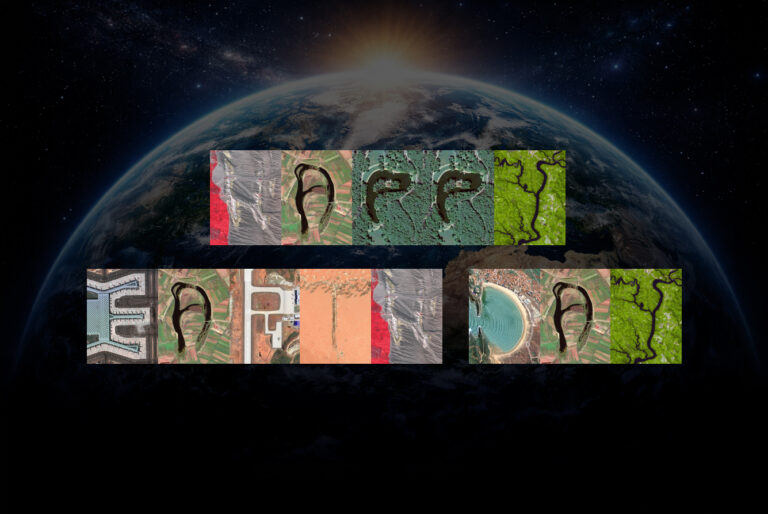
The Satellite Alphabet. 26 Letters Found on Earth from Space.
Read

Story behind the image
2026 · 03 · 17
Monitoring the Mar Menor from Space: Wide Swath and Very High-Resolution Perspectives
Read

Case study
2026 · 02 · 10
A-5 Urban Highway Undergrounding Observing Madrid’s Transformation from Space
Read

Case study
2026 · 01 · 13
The Chiquitano Forest A Decade of Change Seen from Space
Read
News
2025 · 12 · 04
ESA and GEOSAT Join Forces to Accelerate Space Entrepreneurship and Sustainable Innovation.
Read

News
2025 · 11 · 18
Monitoring the Blatten Landslide through Satellite Imagery
Read
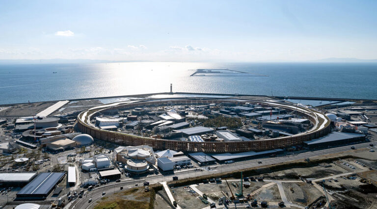
Story behind the image
2025 · 10 · 10
From Empty Land to Expo Osaka 2025
Read

News
2025 · 07 · 23
Cerro Dominador Solar Thermal Plant. High-Tech Solar Power, Seen from Space.
Read

News
2025 · 06 · 23
Optical VHR2024 Coverage.
The Truly European Coverage of Europe.
The Truly European Coverage of Europe.
Read

Case study
2025 · 06 · 10
Deforestation over the decade in Niedererbach, Germany
Read