A view from space.
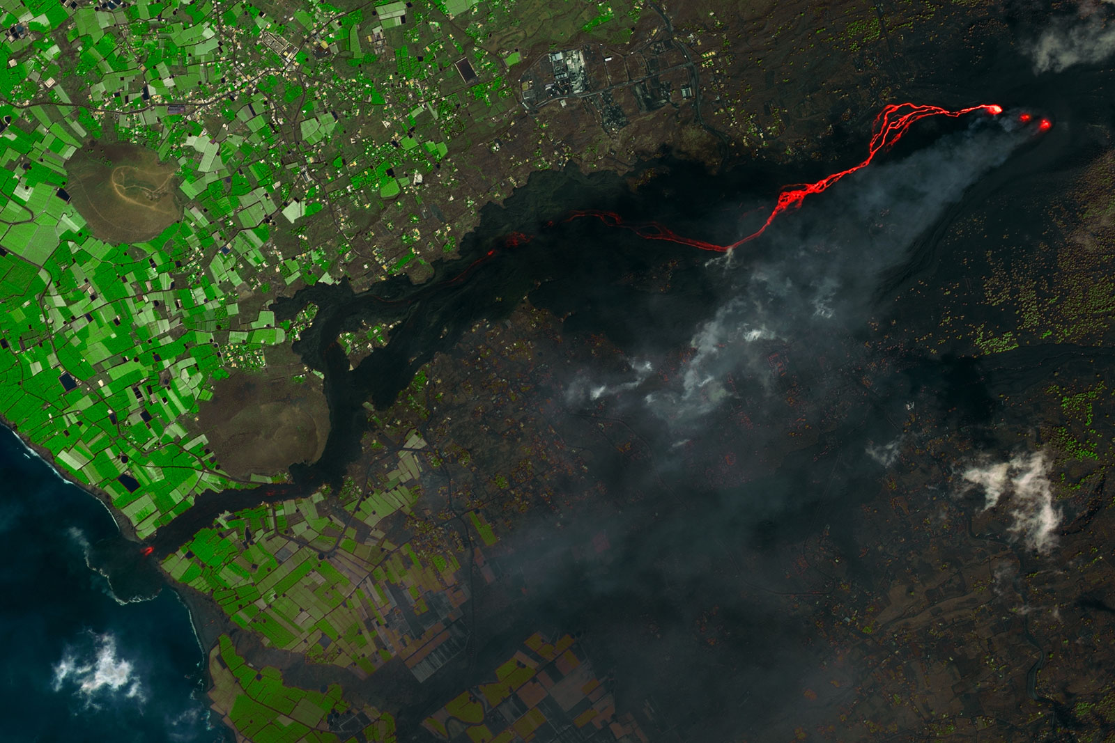
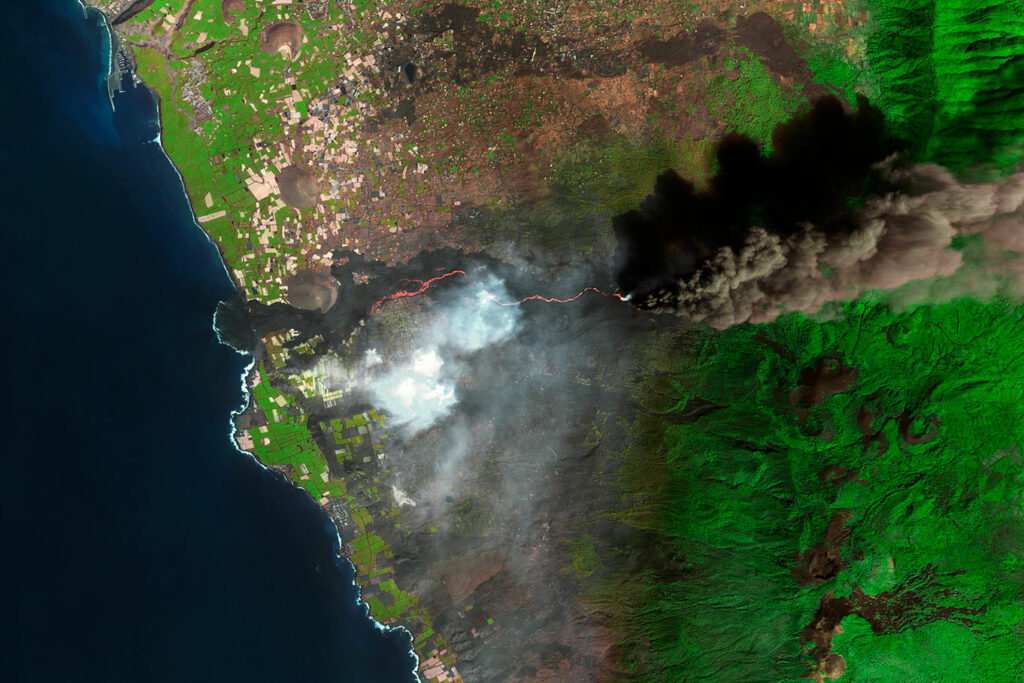
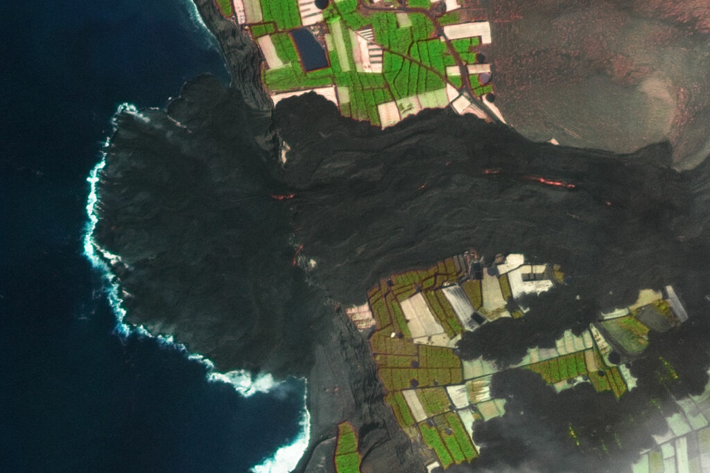
The year 2021 witnessed a striking event on the island of La Palma in the Canary Islands in Spain: the eruption of the Cumbre Vieja volcano. This volcanic eruption, which began on September 19, triggered a humanitarian and climatic crisis that deeply affected the island and its inhabitants. Amid this crisis, satellite images and data collected became an essential tool for monitoring and managing the eruption, as well as understanding its impacts.
The eruption of the Cumbre Vieja volcano was a geological event that raised immediate concerns. Satellite images, offering a comprehensive view of the island from space, allowed scientists and authorities to identify the exact point of the eruption’s onset. This facilitated the early evacuation of at-risk areas and the protection of people’s lives.
Near real-time monitoring
GEOSAT’s satellite data were used to assess the evolution of volcanic activity, the spread of lava, and the formation of new fissures. By observing satellite images in near real time, scientists could anticipate changes in the lava flow and adjust their response strategies.

Humanitarian and environmental crisis management
The eruption not only generated a climatic crisis but also a humanitarian crisis. Thousands of people were forced to evacuate their homes and faced challenges regarding shelter, food, and basic services. Satellite images were used to identify populated areas and assess the magnitude of displacements, enabling authorities to coordinate an effective response. Additionally, these images facilitated the identification of safe evacuation routes and areas requiring humanitarian assistance.
Also had a significant environmental impact. Satellite images provided information on the extent of lava flows and their impact on nearby vegetation and bodies of water. This was crucial for assessing the magnitude of environmental degradation and planning long-term recovery measures.
The 2021 eruption of the Cumbre Vieja volcano illustrates the value of satellite images in managing humanitarian and climatic crises. They deliver timely information, allow for constant monitoring, and help coordinate an effective response.
Thanks to our own satellites, together with our partners, we deliver high quality imagery and analytics for high impact insights which result in improved decision making.