The resilience of the aral sea, the causes and consequences of its drought, and GEOSAT’s data as a powerful tool to tackle it.
The aral sea. A testament to human resilience
Amidst the challenges faced by our planet, the story of the Aral Sea stands as a testament to human resilience and the power of technology to shed light on pressing environmental issues. Once a tragedy of ecological proportions, the drying of the Aral Sea has spurred efforts to understand its causes and consequences, while also providing a beacon of hope through innovative solutions like GEOSAT’s satellite data.
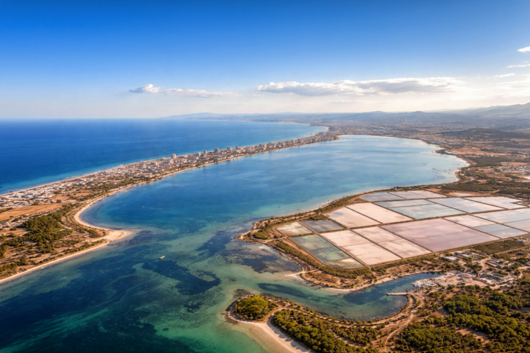
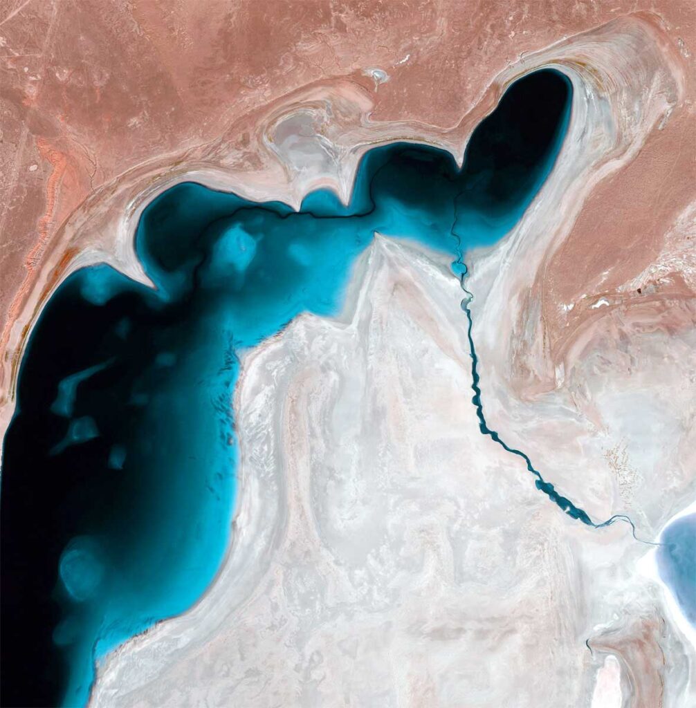
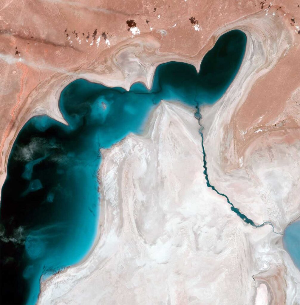
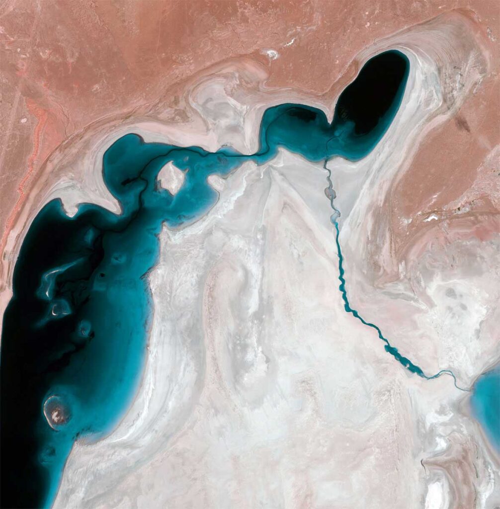
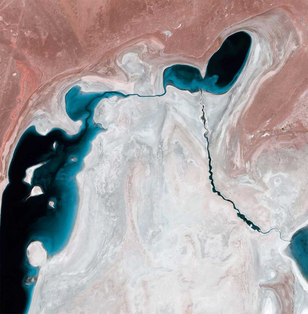
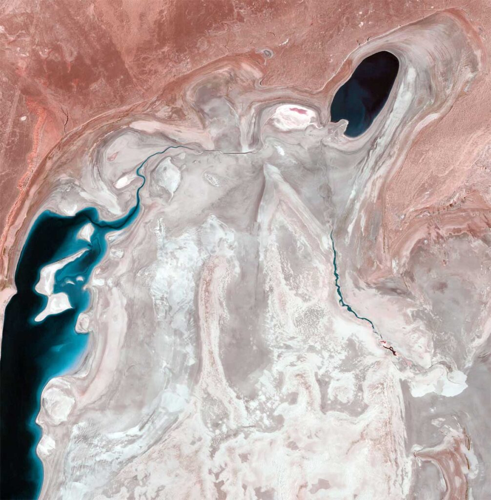
The Aral Sea, located between Uzbekistan and Kazakhstan, was once a thriving oasis, teeming with marine life and supporting vibrant communities. However, the diversion of its main water sources, the Amu Darya and Syr Darya rivers, for agricultural purposes led to a steady decline in water levels over the past few decades. What was once a vast body of water has now become a fraction of its former self, leaving behind vast salt plains and a reminder of the consequences of human actions on nature.
GEOSAT pioneering satellite technology for insight
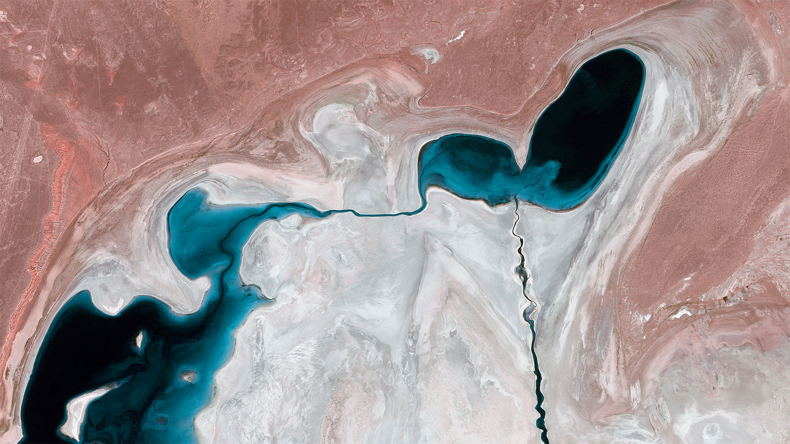
Specialized in the operation and commercial exploitation of Earth Observation systems, GEOSAT offers an advanced and innovating satellite imagery technology, and a unique opportunity to study the transformation of the Aral Sea in unprecedented detail.
GEOSAT’s data play a crucial role in understanding the current state of the Aral Sea and its surrounding areas. By providing a comprehensive view of the sea’s water levels, the extent of desertification, and the impact on neighboring ecosystems, this data serves as a foundation for informed decision-making and targeted interventions.
Researchers can use chronological images to analyze historical changes in the Aral Sea, tracking the extent of its decline and its effects on local habitats. This invaluable information empowers environmentalists and policymakers to develop sustainable solutions for the region’s revival and restoration.
Hope for the future
Researchers can use chronological images to analyze historical changes in the Aral Sea, tracking the extent of its decline and its effects on local habitats. This invaluable information empowers environmentalists and policymakers to develop sustainable solutions for the region’s revival and restoration.


Thanks to our own satellites, together with our partners, we deliver high quality imagery and analytics for high impact insights which result in improved decision making.