
•
Maritime
Ocean satellite imagery for effective maritime surveillance in the most remote areas of the world
Co-ordinating multi-resolution satellites to get you the best insights on port monitoring & maritime safety and security
Precise Satellite data for Maritime
Extreme weather conditions make it difficult to capture Ocean Satellite Imagery. This is problematic for maritime surveillance and environmental monitoring in remote maritime locations, where you must catch rare or unexpected events and track them as they develop. Addressing maritime safety & security concerns, environmental regulations, global supply chain disruptions, technological integration hurdles, and the persistent threat of piracy and maritime crime are other major challenges in this sector. Fortunately, GEOSAT stands as one of the top Maritime Satellite Providers. With our 24/7 on-demand tasking and quick response time (down to 20 minutes), we offer high and very high-resolution (VHR) multispectral images, including our cutting-edge tip & cue technique, that makes us excel in change detection of certain areas over time and in maritime emergency response. Through our satellite data, maritime operators can enhance safety by monitoring vessels in near real-time, enabling swift responses to emergencies and potential hazards. Additionally, we help you mitigate supply chain disruptions by offering precise route optimization and weather patterns studies. Our satellite data integrates seamlessly with existing systems, fostering efficient data exchange and technological integration. Moreover, we help you deal with illegal activities by constant surveillance, allowing a swift intervention, bolstering overall security in the maritime domain.
Thanks to our AI feature detection we can automatically detect ships on the images. Our Emergency Response Team ensures swift, reliable support during crises.
Oil spill
Oil spill detection satellite imagery analytics
•
Maritime surveillance management through ocean satellite imagery

Mission support
Our services include near-real-time imagery delivery (within 20 minutes), rapid on-demand high-resolution imaging through our rush tasking service, and continuous 24/7/365 support from our dedicated expert team. Providing precise change detection analysis for the most accurate information on maritime surveillance.

HR/VHR Multispectral Images
We are uniquely positioned to deliver high-resolution imagery with different spectral bands, that can highlight and better detect vessels and ships, while the very high spatial resolution is important to identify them.

Mosaic Images
We combine multiple satellite images to create seamless compositions by bolster maritime safety measures by offering a comprehensive view of vessel movements, potential hazards, and navigational obstructions, aiding in early threat detection and swift response to emergencies.

Tip & Cue
Using an accurate and cost-effective technique, we coordinate activities between diverse sensors aiding maritime surveillance in remote, inaccessible regions; our continuous satellite imagery offers reliable, up-to-date monitoring, operating 24/7, while ground stations ensure frequent data download.

Emergency Response
When disasters strike and crises unfold, our Maritime Emergency Response Team swiftly coordinates the collection and delivery of essential imagery, applied earth observations and remote sensing, empowering decision-makers to take immediate action.

Change Detection
Services like Port Monitoring & Maritime Tracking enable us to identify and classify vessels. Additionally, our high-resolution data is a key source of information to detect changes in incredible detail that complement ground assessment information.

AI Feature Detection
AI Feature Detection: We combine satellite data with AI techniques to efficiently detect, analyze, and derive valuable insights across multiple sectors and applications, including automatic ship detection.
Thanks to our own satellites, together with our partners, we deliver high quality imagery and analytics for high impact insights which result in improved decision making.
Get a demo
•
Market Samples
We work to build and deliver customized solutions in a large variety of applications and industries.

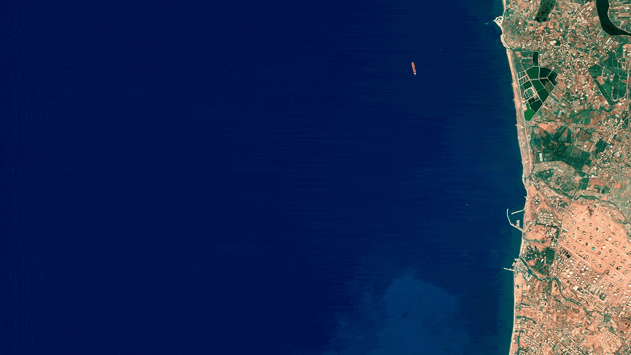
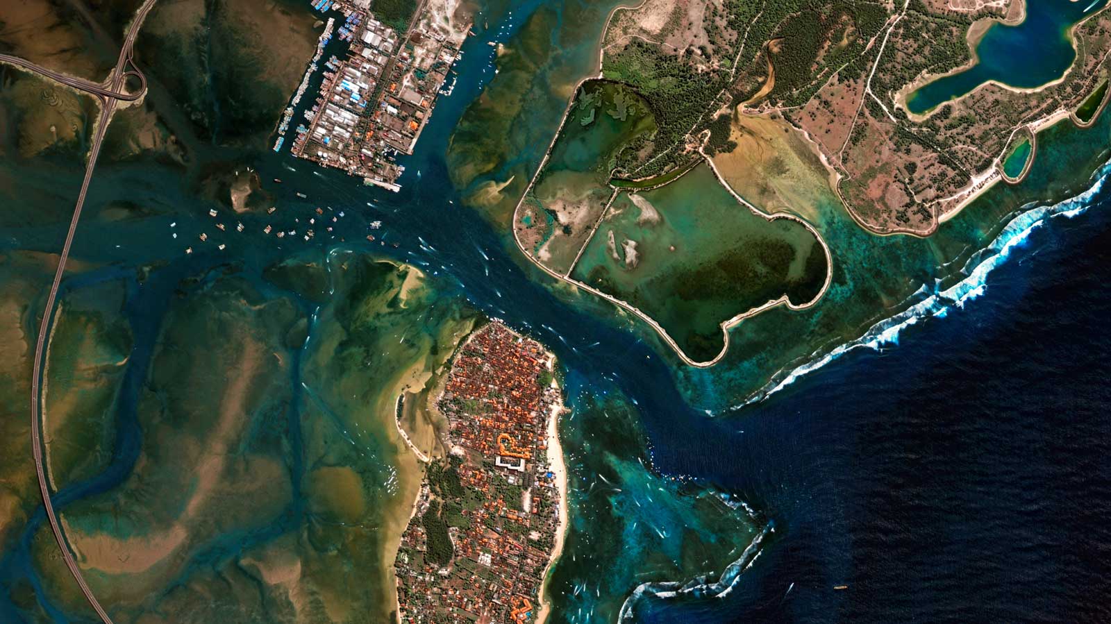
VHR Satellite Imagery
Bali high-resolution satellite imagery providers

VHR Imagery, Port Surveillance
Miami USA Very high-resolution satellite imagery

VHR Image, Port Surveillance
Amberes port up-to-date satellite images

VHR Image, Port Surveillance
Amberes port real time satellite imagery

Near-real time image
Gibraltar best high-resolution satellite imagery

VHR image for maritime traffic surveillance
Suez Canal birdseye satellite imagery

VHR image for vessel detection
Puerto del Callao, Peru satellite data analytics
VHR image for maritime traffic surveillance
Port-of-Singapore big data analytics via satellite maritime transport

VHR image for maritime traffic surveillance
Suez Canal satellite analytics
•
Benefits of using ocean satellite imagery
Target Identification & Tracking
Our satellites make it possible to revisit the same area with great frequency. This capability is perfect for detecting suspicious activity, ensuring maritime safety and security, identifying vessels, and monitoring changes.
Area Monitoring (Straits, Ports, Maritime Routes)
Leveraging their rapid revisit capability, our satellites can swiftly capture another image of the same area, simplifying Port Monitoring and Maritime Surveillance.
Supply Chain Management
We offer you a 24/7 Tasking and Delivery Service, providing tailor-made solutions for any area of interest, anywhere in the world. We supply you with actionable intelligence for your business through a cloud-based application environment.
Oil Spill Detection
Our technology can quickly and accurately identify oil spills on the water’s surface. This enables prompt and targeted response efforts, facilitating timely intervention to mitigate the environmental impact.
Anti-Piracy Support
We provide all-weather monitoring for effective maritime surveillance, to support the detection of illegal or irregular activity at sea and to make maritime activities safer and more efficient.
Compliance Management
Compliance management is integral to our operations. As a provider of earth observation solutions, we prioritize adherence to legal, regulatory, and industry standards governing our field.
Embark on a journey with GEOSAT
Whether you work in maritime surveillance, vessel monitoring, or ship detection, you need information to help you decide how to deploy your resources and budget as efficiently as possible. Getting up-to-date, reliable information quickly can be difficult when you don’t – or can’t – have people on the ground. By coordinating our network of satellites, we can give you cost-effective access to multi-resolution imagery of and reveal insights about the maritime locations that matter to you. From maritime tracking, port monitoring, and oil spill detection to anti-piracy efforts, our comprehensive services make us the top choice for precise, near real-time maritime imagery needs.
Contact us
More GEOSAT Areas of Expertise
View All
Story behind the image
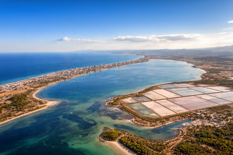
2026 · 03 · 17
Monitoring the Mar Menor from Space: Wide Swath and Very High-Resolution Perspectives
Read
Story behind the image
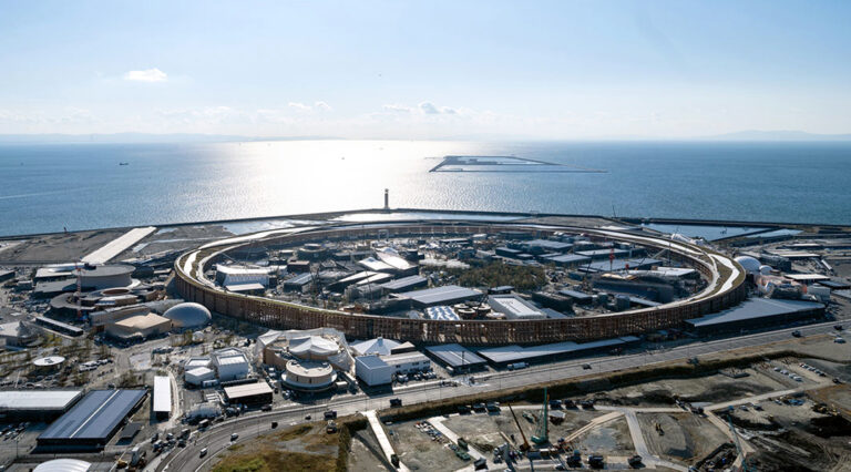
2025 · 10 · 10
From Empty Land to Expo Osaka 2025
Read
Case study
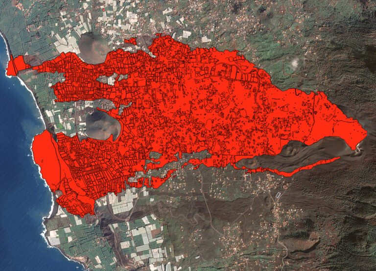
2024 · 06 · 13
Rebirth from ashes: Analysis of the 2021 Cumbre Vieja eruption & the path to recovery
Read