•
Mapping
Revolutionizing land mapping with unparalleled large area coverage
We supply satellite mapping services for urban planning, offering a global geographical scope and a wide range of high-quality land administration and geo mapping data.
Precise Satellite imagery for Mapping
The Land Mapping sector faces various challenges, including limitations in accuracy, time-consuming manual surveys, and the inability to access remote or inaccessible terrains. These issues often lead to incomplete or outdated maps, hindering effective decision-making for urban planning. As one of the geospatial mapping companies, GEOSAT offers a transformative solution.
With Very-High Resolution (VHR) imagery, advanced technologies, and expertise with spatial mapping software and remote sensing, our satellite data provides a comprehensive, up-to-date, and detailed view of the Earth’s surface.
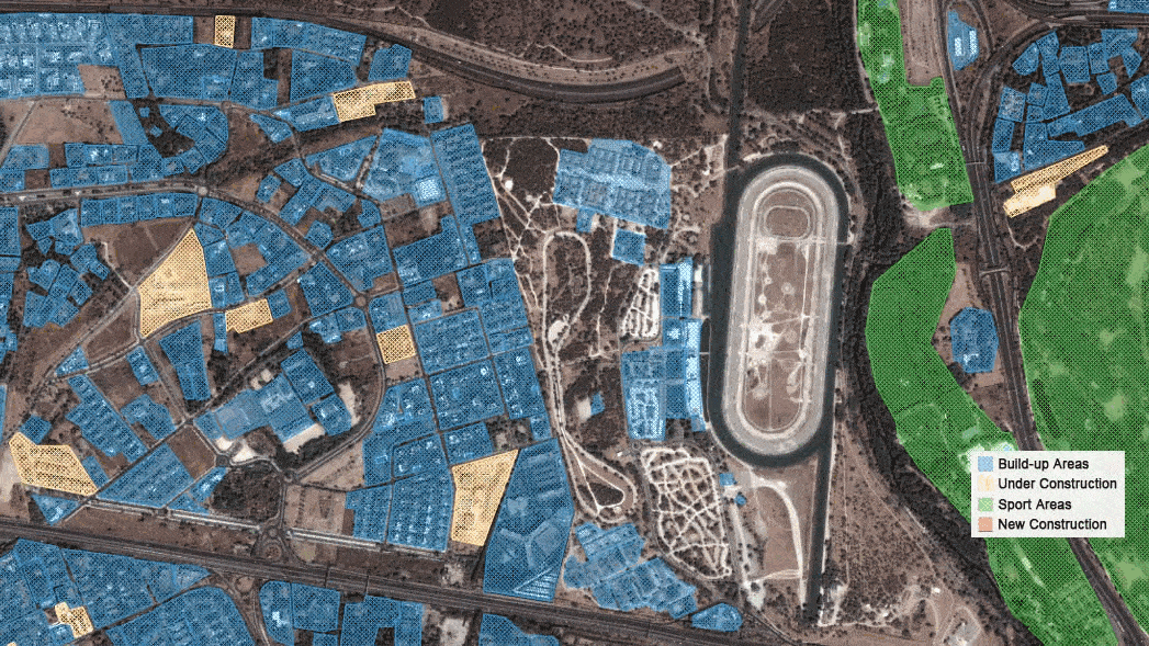
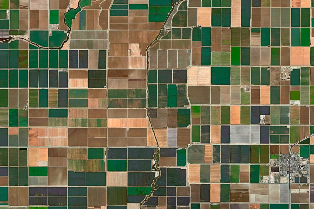
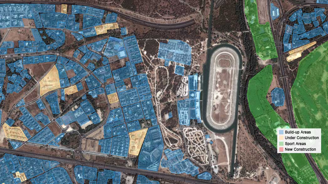
Land classification over Madrid
Land classification over time (3 years) in Madrid, Spain.
•
Our land mapping satellite data's main capabilities

Very High-Resolution Satellite Imagery
Super Resolution enhanced pansharpened imagery at 40cm for detailed assessment, 1,6m scientific level enhanced resolution on each Multispectral data band. High-frequency, multi-resolution monitoring, and Federated Missions imagery (MR, HR and VHR).

Mosaic Images
We combine multiple satellite images to create seamless compositions that you can use to create accurate cartography maps.

Stereo (Digital Surface Model)
Our Very-High-Resolution stereoscopic imagery is crucial for developing 3D and Digital Elevation Models.

Territory/Land Coverages
For comprehensive coverage, we offer monitoring and analysis capabilities across vast land areas, including remote or inaccessible regions.

AI Feature detection
By combining satellite data with AI techniques, we efficiently detect, analyze, and derive valuable insights across multiple sectors and applications.
Thanks to our own satellites, together with our partners, we deliver high quality imagery and analytics for high impact insights which result in improved decision making.
Get a demo
•
Market Samples
We work to build and deliver customized solutions in a large variety of applications and industries.
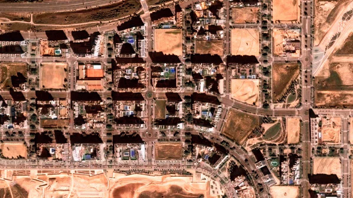
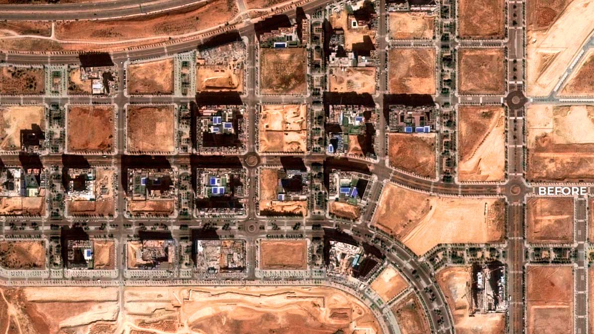

Valdebebas, Madrid
Change detection over a construction in Valdebebas


Hyderabad, India
DEM Digital elevation model over Hyderabad, India

Madrid
Land classification over Madrid

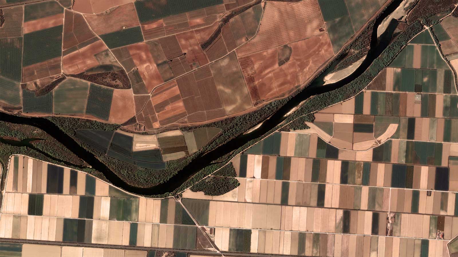
Ebro, Spain
Ebro River Spain latest satellite imagery

Manhattan, NY
Manhattan, New-York, USA - satellite analytics

Mexico City
Mexico, high resolution daily satellite imagery
•
Advantages of using our land mapping satellite services
Worldwide Access to VHR imagery
We provide global access to up-to-date very-high-resolution imagery, with an unprecedented coverage and an unparalleled catalog with 10+ years of archive.
Data integration support (IoT integration)
By combining satellite data with AI techniques, we efficiently detect, analyze, and derive valuable insights across multiple sectors and applications.
Multiple formats & products available
Explore cartography maps, ortho dems, road safety assessment, building footprint, zoning analysis, etc.
Embark on a journey with GEOSAT
GEOSAT is a game-changer in the Land Mapping sector due to our multifaceted advantages. Our global coverage and high-resolution imaging capabilities offer you a comprehensive view of the Earth’s surface, facilitating accurate and detailed mapping of diverse terrains, urban areas, and natural features. Moreover, the accessibility and consistency of our satellite data streamline processes, minimizing costs associated with field surveys and enabling access to remote or inaccessible regions, thus revolutionizing land mapping by enhancing accuracy, efficiency, and accessibility while supporting sustainable and inclusive development strategies.
Contact us
More GEOSAT Areas of Expertise
View All