
•
Agriculture
Agriculture satellite imagery to optimize productivity with very high revisit frequency and fast delivery
Thanks to our high and very-high resolution satellites, we can extract valuable insights that help us detect changes in agricultural land with extreme precision.
Precise Satellite Data for Agriculture
Agriculture is vital for our survival on this planet. However, its conditions are ever-changing, and the sector must evolve to face the challenges of climate uncertainty, resource scarcity, and the soaring prices of seeds, pesticides, and water. GEOSAT’s satellite data for agriculture and Precision Crop Tech provide unique solutions to alleviate these challenges. This technology offers invaluable insights into optimizing resource allocation and delivering near real-time monitoring of crop health and enables precise identification of areas requiring water or pesticide application.
Plus, our precision agriculture satellite imagery and data contribute to predictive analytics, allowing farmers to anticipate and adapt to climate changes, optimize planting times, and select suitable crop varieties resilient to varying conditions. Our state-of-the-art technology facilitates efficient water management and crop diagnosis through precise irrigation planning, minimizing waste and maximizing yield. By harnessing our satellite data, the agricultural sector gains a powerful tool to address these challenges and bolster sustainability, productivity, and resilience in farming practices.
Crops in Washington, USA.
Crop monitoring and change detection over wide areas
•
Our satellite data's main capabilities for Precision Agriculture

Very High-Resolution Satellite Imagery
Pansharpened imagery at 40cm for detailed assessment, 1,6m scientific level enhanced resolution on each Multispectral band. Your ideal solution for intra-field surveillance, access to information inside small parcels, water stress, yield estimation, information on irrigation, inventory, and plot delineation. Large parcels and national phenomena monitoring, such as drought assessment, crop type mapping, food security and overstock risk assessment.

10+ Year Archive
Our extensive and up-to-date archive of satellite imagery for agriculture provides you with the perfect dataset to monitor development over time in any area, assess the field, detect changes, and anticipate situations relevant to your business.

Multi-Spectral Data
Multispectral data captures a spectrum of colors beyond what our eyes can see. Our use of satellite imagery in agriculture with a range of multispectral imagery reveals hidden details about what’s in the image that helps us analyze crops and extract the best analytics to manage them.

Indexes
By combining different bands or wavelengths in the data, we can extract more information and calculate essential crop health indices (NDVI, EVI, CVI & GNDVI). These indices provide valuable insights that enhance your understanding of the crops and their overall condition.

Territory/Land Coverages
From continental to plot scale, our medium and very high-resolution agricultural monitoring ensures coverage of all crops, allowing us to extract valuable data with a resolution of up to 40 cm.

Change Detection
The Images we take enable us to detect early changes to crops, such as growth water stress, soil erosion and soil moisture which gives farmers time to save their yield. We offer value-added products which allow you to make a crop diagnosis.
Thanks to our own satellites, together with our partners, we deliver high quality imagery and analytics for high impact insights which result in improved decision making.
Get a demo
•
Market samples
We work to build and deliver customized solutions in a large variety of applications and industries.

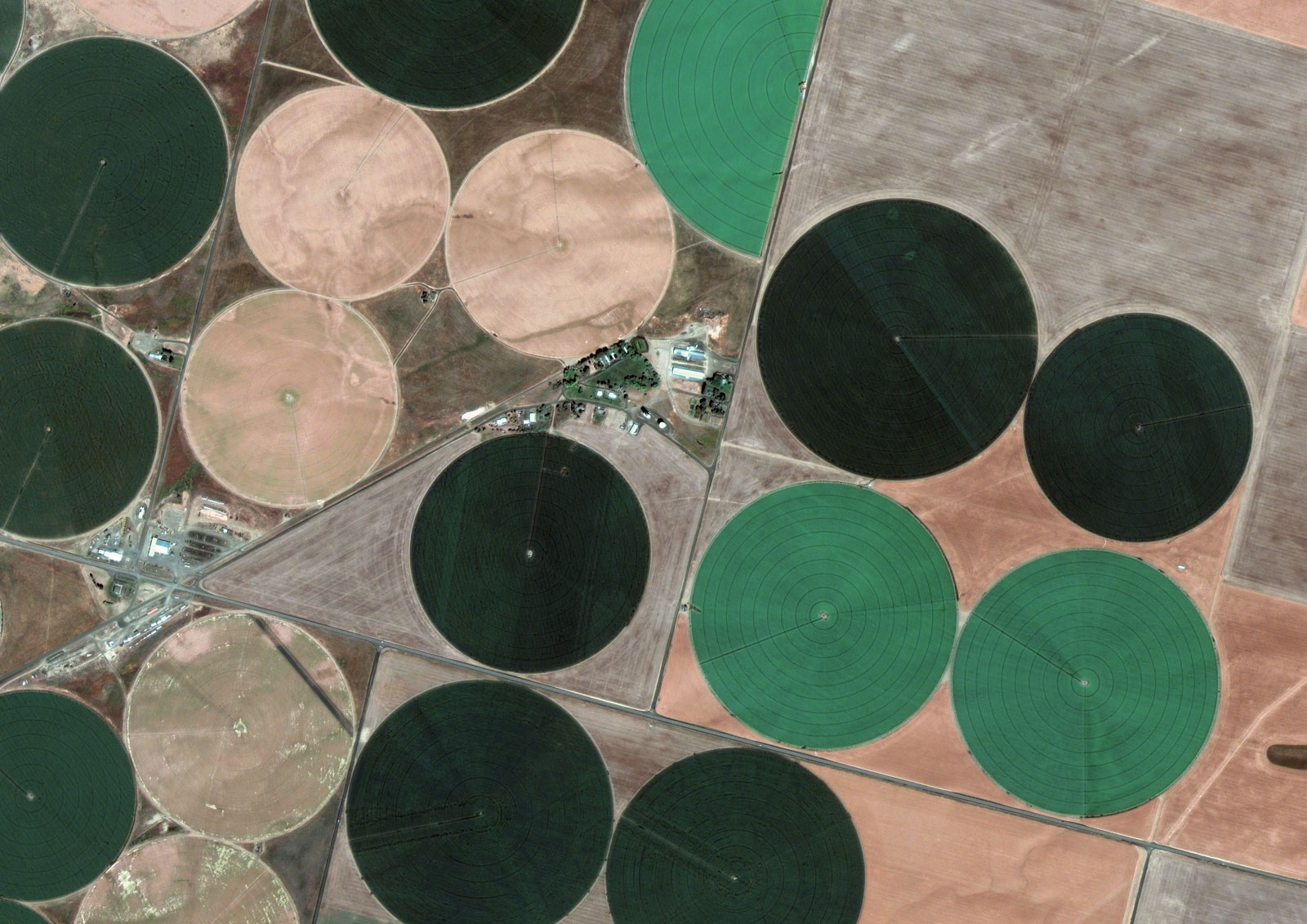
Crops in Washington, USA
Fruit, wheat, legumes & alfalfa crops in Washington, USA
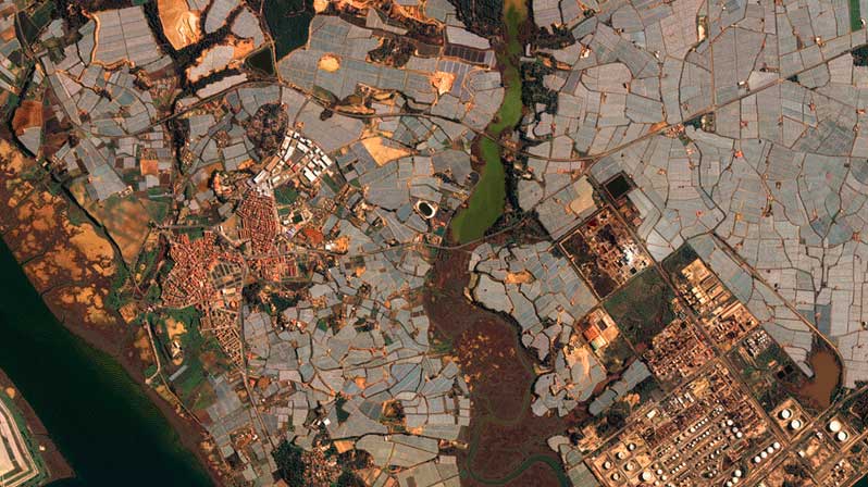
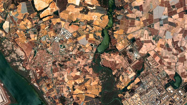
Greenhouses in Huelva, Spain
Fruit and vegetable crops in Huelva, Spain

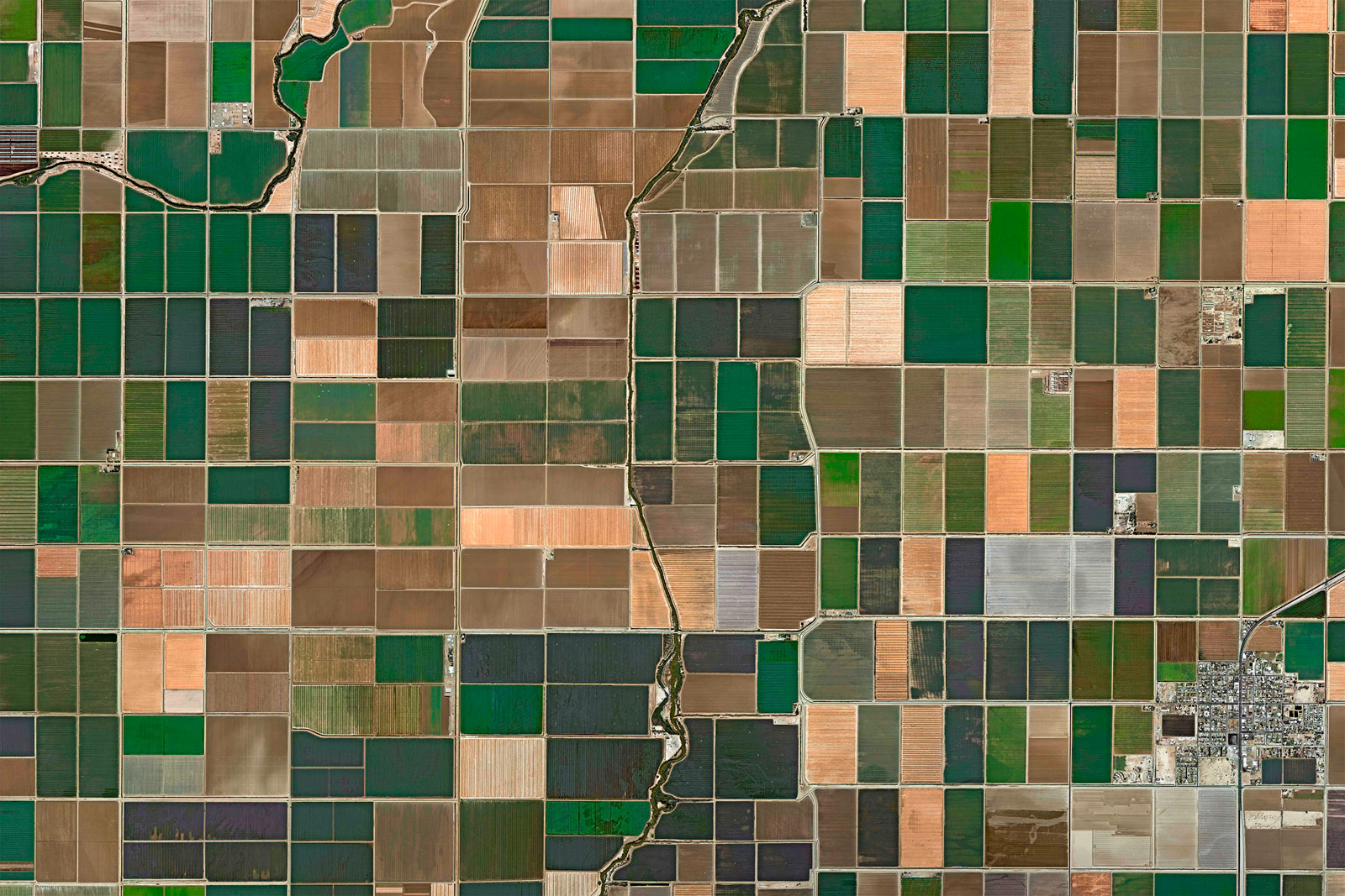
Crops in Salton Sea, CA, USA
Citrus, vegetable & cereal crops around Salton Sea, CA, USA.

Crops in Yuma, AZ, USA
Lettuce, asparagus & broccoli crops in Yuma, AZ, USA

Vineyards in Logroño, Spain
Vineyards in Logroño, Spain

Crops in Noordwijk, Netherlands
Tulip fields in Noordwijk, Netherlands

Crops around the Ebro River, Spain
Rice, fruits, vegetables, olives & nuts crops around the Ebro River, Spain

Crops near South Holland, Netherlands
Fruit, vegetable and flower crops near South Holland, Netherlands

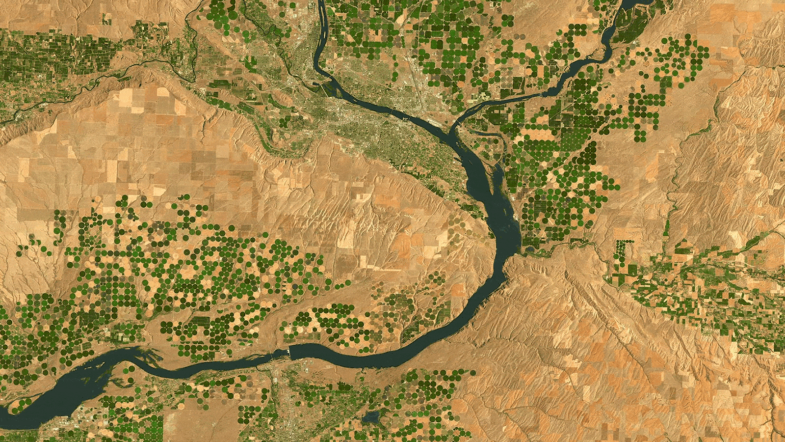
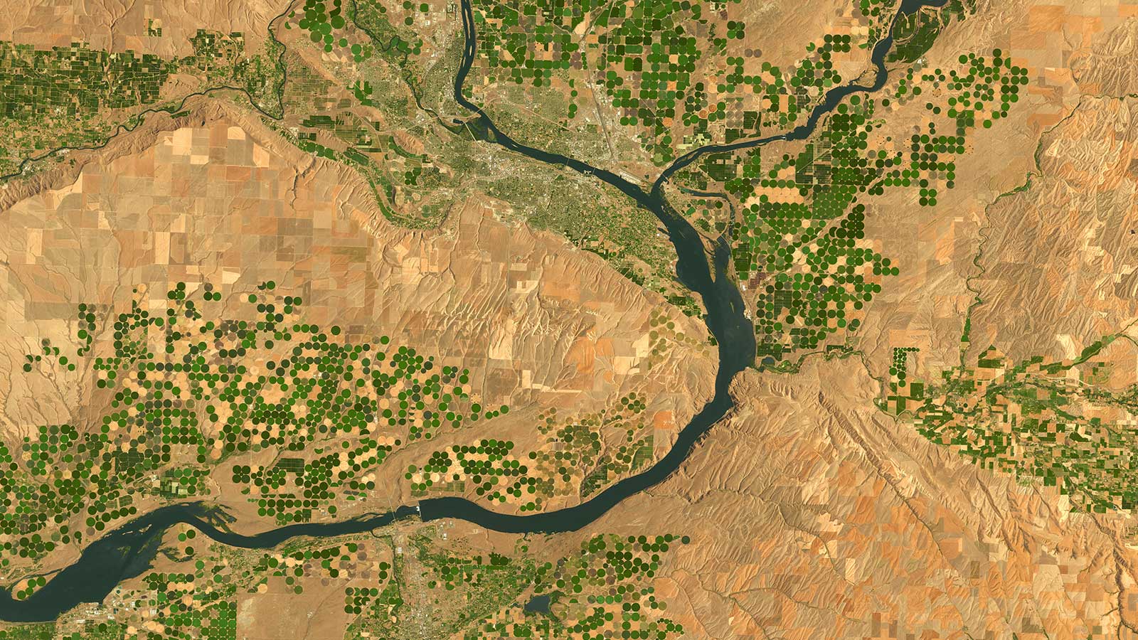
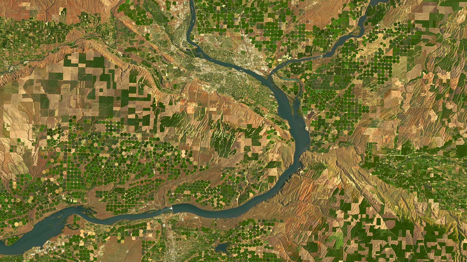
Imperial County, CA, USA
Cotton, melons, vegetables & alfalfa crops in Imperial Valley, CA, USA


Pistachio Crops, Fresno, CA, USA
Multispectral image and NDVI index
•
Advantages of using our satellite data for agriculture
Supply Chain Management
We offer you a 24/7 Tasking and Delivery Service, providing tailor-made solutions for any area of interest, anywhere in the world. We supply you with actionable intelligence for your business through a cloud-based application environment.
Cost & Resources Management
We offer seamless access to satellite data for agriculture and workflows, without the need to build and operate costly platforms. Our experienced team validates the data quality and consistency and ensures the delivery of reliable analytics-ready imagery.
Compliance Management
Compliance management is integral to our operations. As a provider of satellite technology in agriculture, we prioritize adherence to legal, regulatory, and industry standards governing our field.
Archive Data & Datasets to predict Climate Impact
Our 10+ year archive allows you to monitor changes to your crops across the years, unlocking the insights you need to farm more precisely and forecast how the climate will impact your land in the future.
Yield Estimation
Our Precision Agriculture Satellite imagery can be used to monitor crop health, growth patterns, and estimate yields. Specific sensors in our satellites can capture various wavelengths, which can be used to assess vegetation health and predict yields.
Embark on a journey with GEOSAT
Precision Agriculture Satellite Imagery offers accurate, frequent, and on-time signals to help detect changes to agricultural lands, monitor productivity, and forecast yield levels. We give you a global geographical scope and an enhanced range of scientific-quality agricultural imagery and analytics with several resolutions, spectral bands, and sensor types that will unlock insights for more efficient farming.
Contact us
More GEOSAT Areas of Expertise
View All
Story behind the image
2026 · 03 · 17
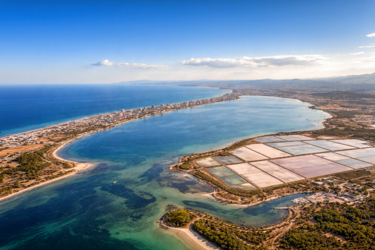
Monitoring the Mar Menor from Space: Wide Swath and Very High-Resolution Perspectives
Read
Story behind the image
2025 · 10 · 10
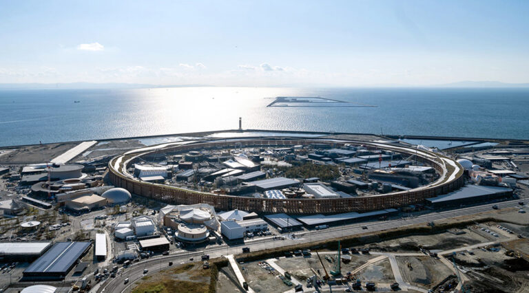
From Empty Land to Expo Osaka 2025
Read
Case study
2024 · 06 · 13
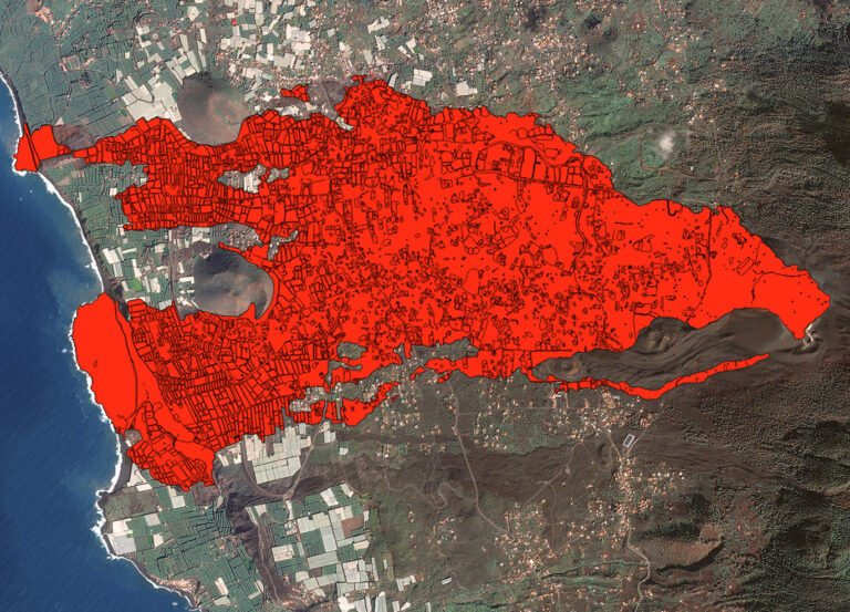
Rebirth from ashes: Analysis of the 2021 Cumbre Vieja eruption & the path to recovery
Read