•
Civil Administration
Satellite-based tailored solutions to support any civil administration branch, from civil protection to land management & smart city projects
From emergency response to infrastructure monitoring, we assist informed decision-making and offer accurate images at a highly competitive cost, scalable to real needs.
•
Civil Protection and Administration
Civil Protection and Administration has a multitude of needs and applications for geospatial data, linked with a broad spectrum of responsibilities toward civil society. At GEOSAT, we can support you with our satellite technology by providing data and services tailored to each area of Civil Administration’s needs.
Central Government & Public Agencies
These entities are responsible for policy and regulations, ensuring the right tools and resources for other administrations to make efficient and timely decisions. Our data can support informed decision-making with:
- Analysis of patterns of life through systematic area monitoring.
- Base maps and coverages.
- Area change detection for land use and land management.
Regional Administration
The administration plays a crucial role in tailoring national government policies to its regions. Besides this, it also ensures that regional infrastructures are adjusted to public needs and plans well in advance for new requirements. We can support proper situational analysis and future planning with services such as:
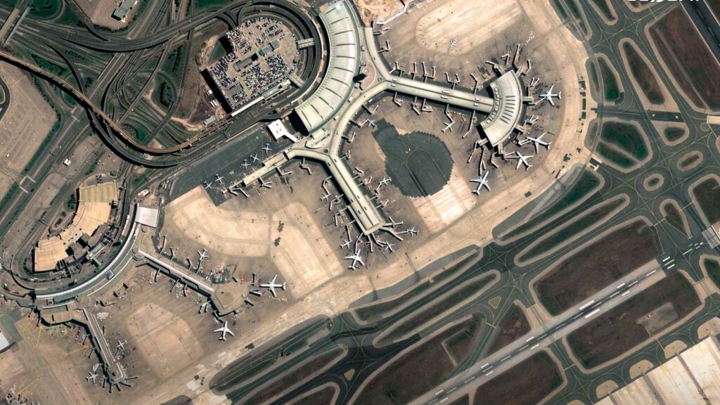
- Critical infrastructure monitoring over time: Roads, Airports, Harbors, Power plants, Wind farms, Solar plants, etc.
- Smart city technologies and solutions.
- Base maps and coverages.
Municipalities or Local Administration
Municipalities have critical responsibilities towards their population, including urban and territory planning, urban sprawl management, smart cities implementation, community services provision, emergency response, and civil protection. With our satellite technology, we can support data for informed and timely actions in areas such as:
- Land use and land cover analysis.
- Construction evolution monitoring by image change detection.
- Licensing checks (Construction, Swimming Pools).
- Emergency response with near-real-time imagery.
- Auditing green areas in cities.
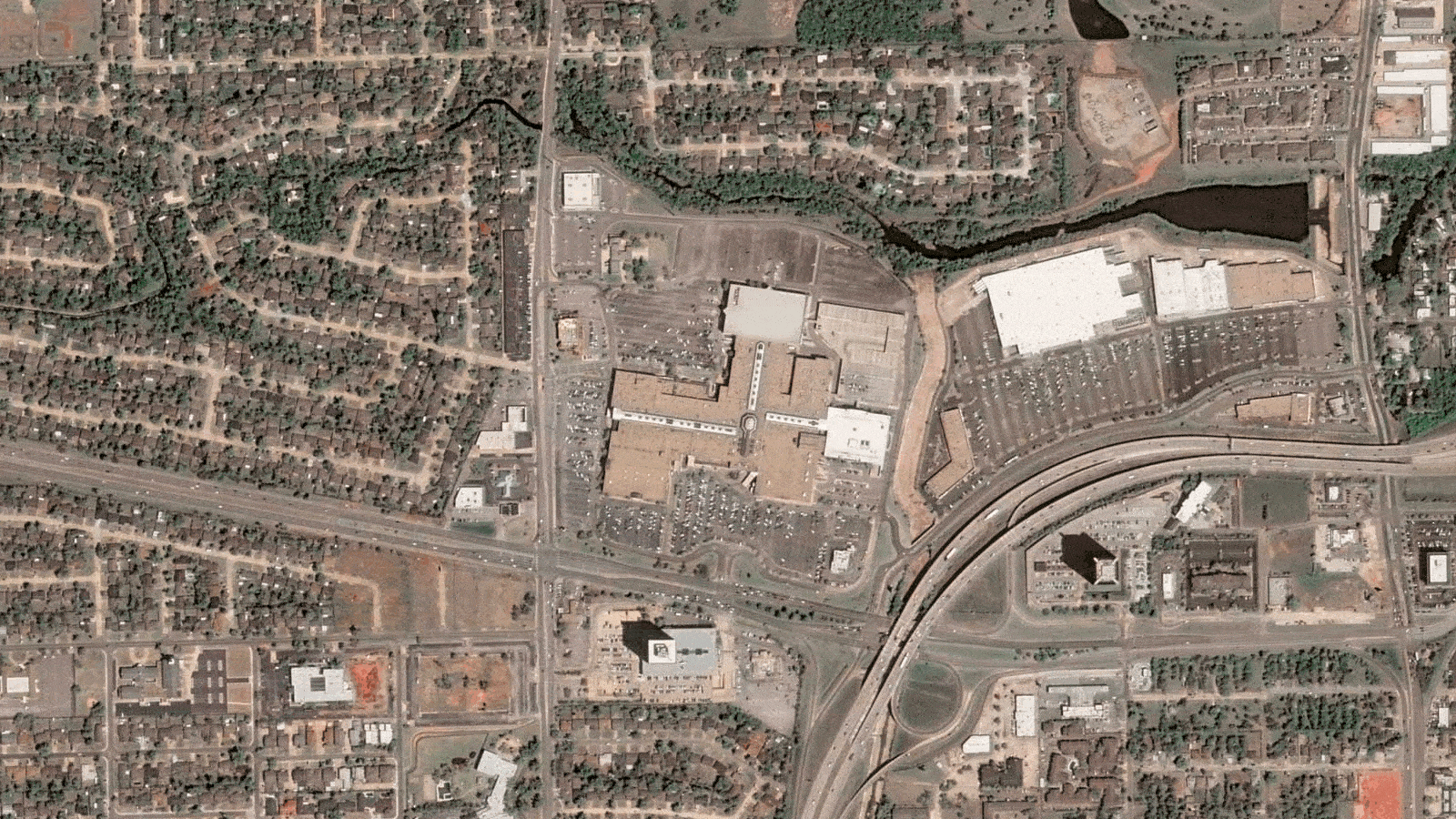
Parking lot at a shopping center in Oklahoma, USA
Before and After Black Friday
•
Our satellite data’s: main capabilities for civil protection and administration:

HR/VHR images
Super Resolution enhanced pansharpened imagery at 40cm for detailed assessment, 1,6m scientific level enhanced resolution on each Multispectral data band. High-frequency, multi-resolution monitoring, and Federated Missions imagery (MR, HR and VHR).

Mosaic Images
By combining multiple images, we provide you with improved spatial resolution, enhanced accuracy in infrastructure monitoring, better analysis capabilities for comprehensive assessments, and more effective decision-making in urban planning, disaster management, and land use.

Tip & Cue
Using an accurate and cost-effective technique, we coordinate activities between diverse sensors to guide a focused collection of additional information over critical areas, optimizing resource allocation and decision-making in targeted areas.

Emergency Response and 24/7 Service
Our services include near-real-time imagery delivery (within 20 minutes), rapid on-demand high-resolution imaging through our rush tasking service, and continuous 24/7/365 service from our dedicated expert team to support early warning systems & civil protection pre alerts’ processes.

Change Detection
We compare current data with historical records by identifying urban growth patterns (urban sprawl) and facilitating informed decision making on urban planning and smart city projects, while effectively monitoring environmental impact.
Thanks to our own satellites, together with our partners, we deliver high quality imagery and analytics for high impact insights which result in improved decision making.
Get a demo
•
Market samples
We work to build and deliver customized solutions in a large variety of applications and industries.

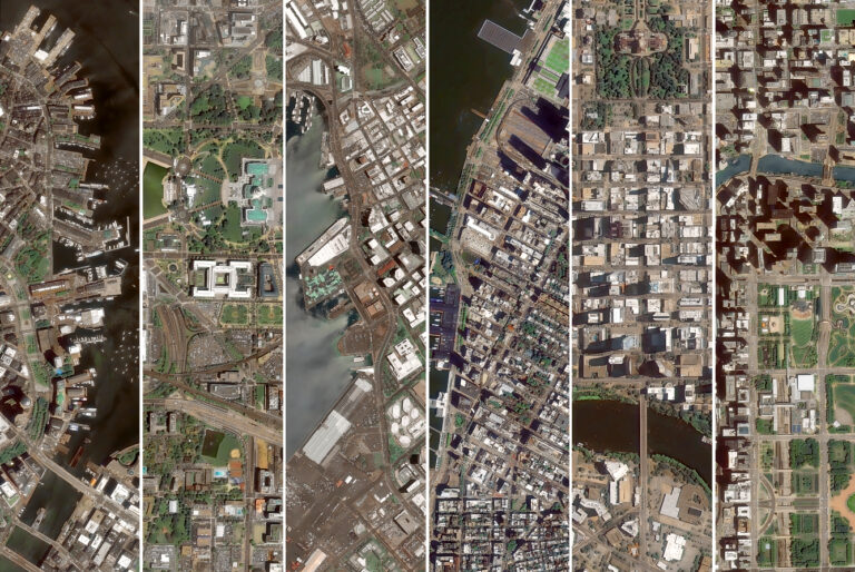
Lisbon

Amsterdam

San Francisco, CA, USA
VHR Satellite Imagery, Port monitoring

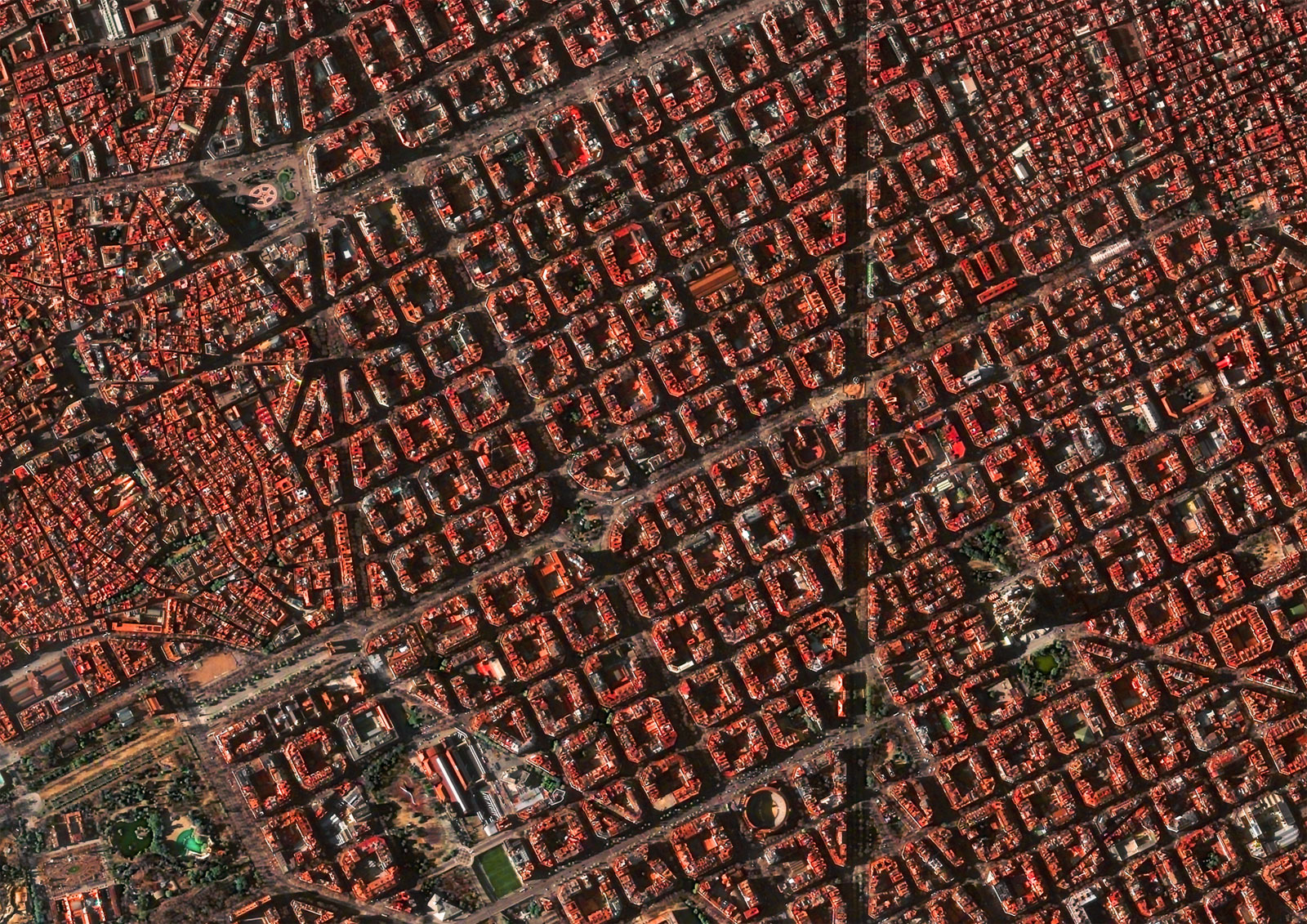
Barcelona

Bordeaux
•
Benefits of using satellite data for Civil protection and administration branches
Streamlined Administrative Processes
We optimize administrative workflows with tailored geospatial solutions, delivering near real-time data for informed decision-making. From civil protection monitoring to smart city implementations, our advanced satellite technology enhances efficiency across Civil Administration branches by offering services like area monitoring and change detection.
Satellite-Driven Monitoring Insights
Unmatched satellite insights to empower decision-makers. Central Governments benefit from tools revealing life patterns and base maps. Regional Administrations gain critical infrastructure monitoring, while Municipalities utilize satellite technology for land analysis and emergency response. Our high-quality data transforms monitoring, providing a comprehensive view for precise decision-making.
Embark on a journey with GEOSAT
We are your strategic partner in revolutionizing administrative processes, offering tailored satellite-based solutions for Civil Administration needs. From near real-time data for informed decision-making to unparalleled insights in monitoring and planning, our technology enhances efficiency across branches. Whether you’re in Central Government, Regional Administration, or Local Municipalities, we provide accurate, cost-effective, and scalable solutions. Explore our unique subproducts, from mission support to AI feature detection, and witness the transformative power of our services. Contact us now for a demo and embark on a journey to heightened capabilities in emergency response, land management, and smart city implementations. Let us be your trusted ally in achieving precision and efficiency.
Contact us
More GEOSAT Areas of Expertise
View All