The United States turns 250 in 2026. We mark it from Space.
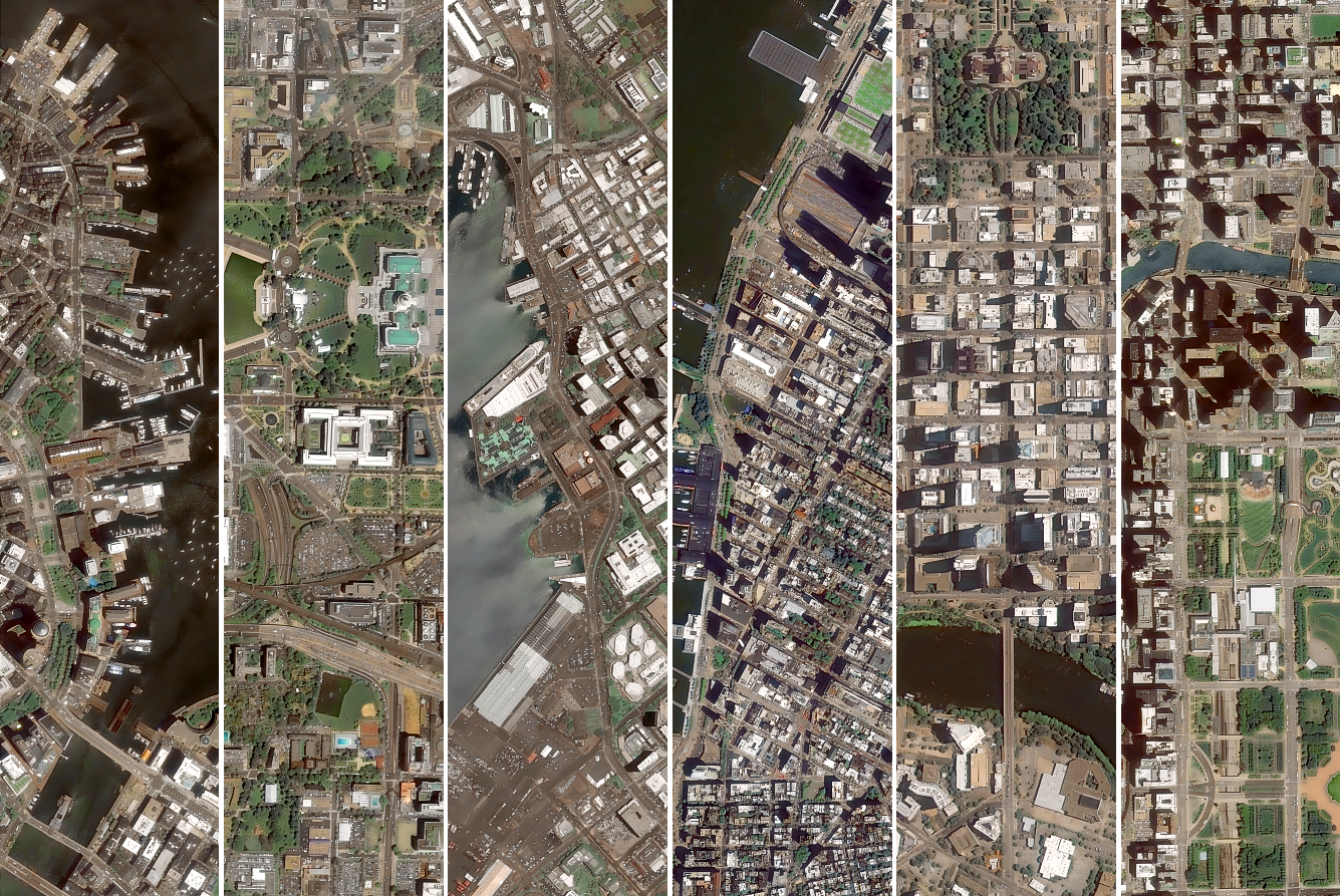
12 American cities, from the dense urban core of New York to the remote capital of Alaska, seen from Space with GEOSAT VHR satellites. Each city is a different story, told through street grids, coastlines, building density, and spatial footprint.
Satellite imagery tells you what cities look like, how dense they are, how they’ve grown, and how they relate to the landscape around them.
This is the foundation of what we do at GEOSAT. Our mapping capabilities are built around very high-resolution imagery that allows for large-area coverage without sacrificing detail.
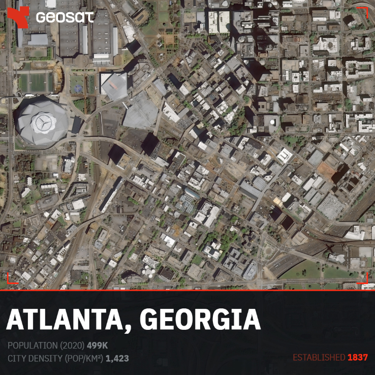

Atlanta, Georgia. Population: 499K · City density (pop/km²): 1,423 · Established: 1837
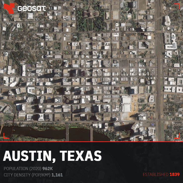
Austin, Texas. Population: 962K · City density (pop/km²): 1,161 · Established: 1839
Boston, Massachusetts. Population: 675K · City density (pop/km²): 5,401 · Established: 1630
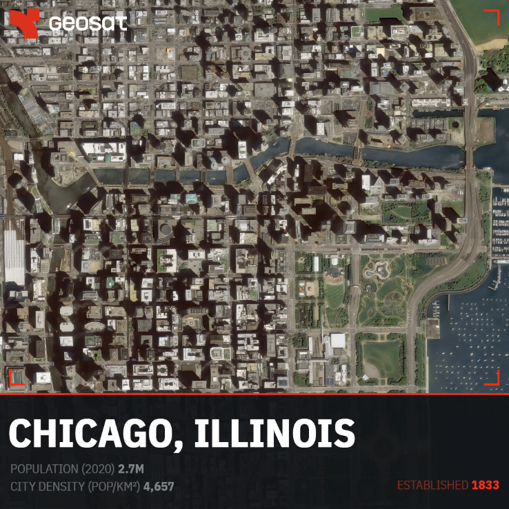
Chicago, Illinois. Population: 2.7M · City density (pop/km²): 4,657 · Established: 1833
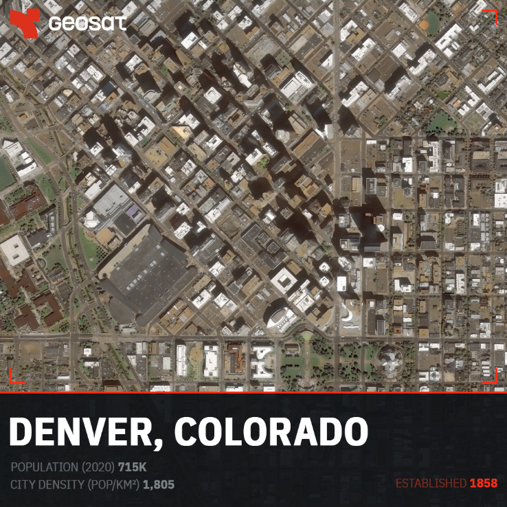
Denver, Colorado. Population: 715K · City density (pop/km²): 1,805 · Established: 1858
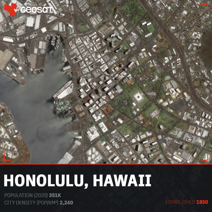
Honolulu, Hawaii. Population: 351K · City density (pop/km²): 2,240 · Established: 1850
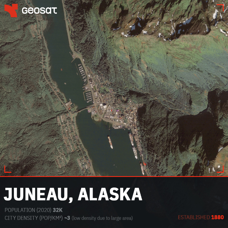
Juneau, Alaska. Population: 32K · City density (pop/km²): ~3 · Established: 1880
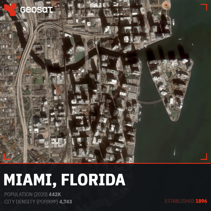
Miami, Florida. Population: 442K · City density (pop/km²): 4,743 · Established: 1896
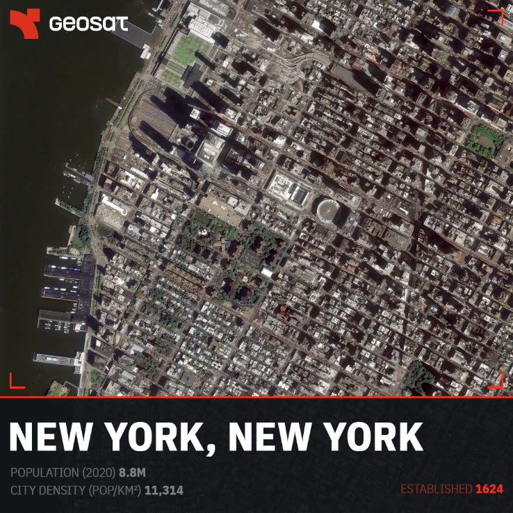
New York, New York. Population: 8.8M · City density (pop/km²): 11,314 · Established: 1624
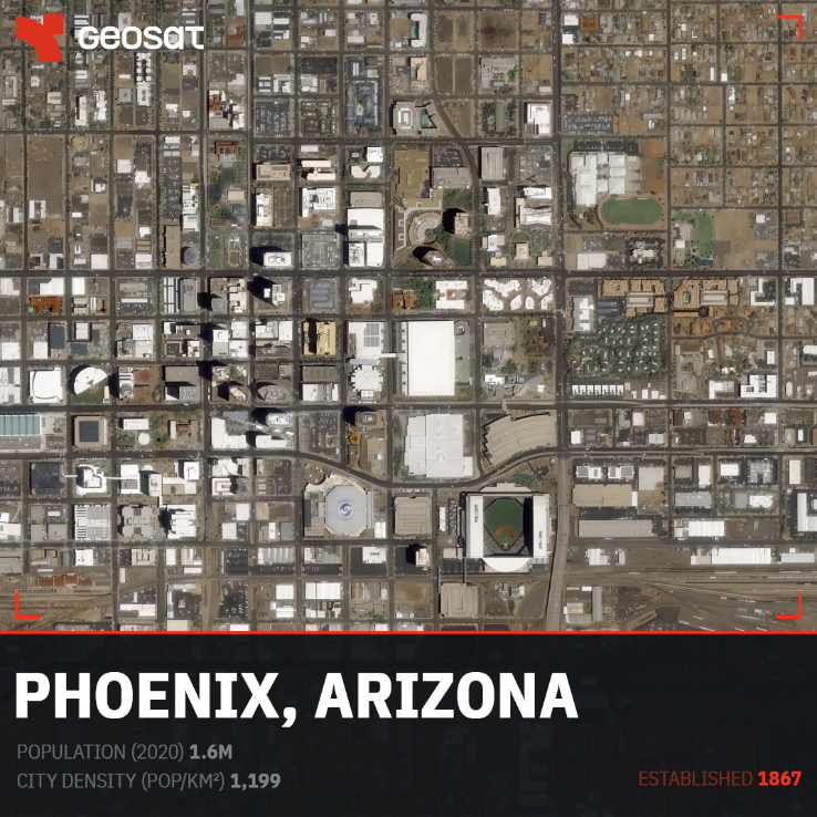
Phoenix, Arizona. Population: 1.6M · City density (pop/km²): 1,199 · Established: 1867
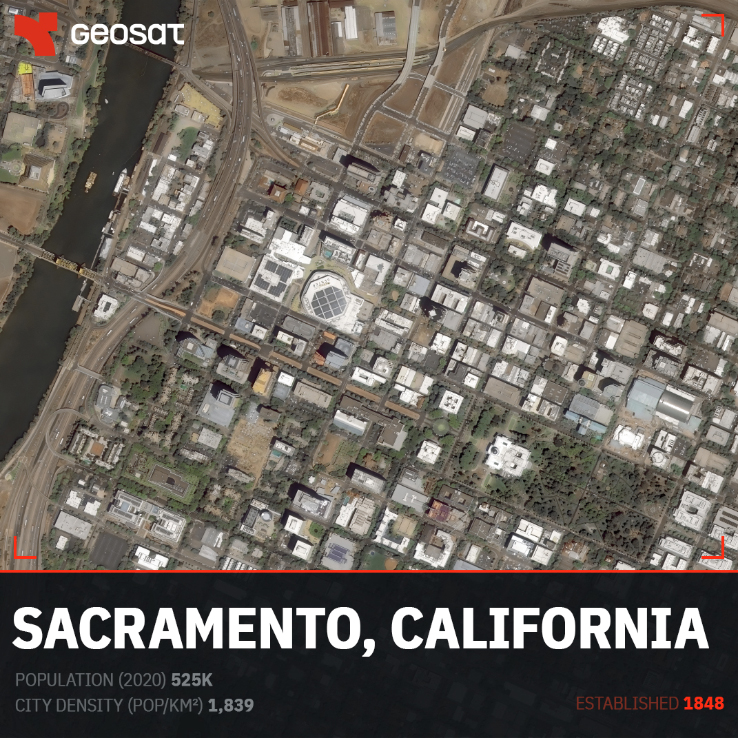
Sacramento, California. Population: 525K · City density (pop/km²): 1,839 · Established: 1848
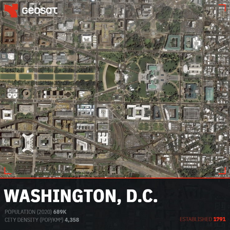
Washington, D.C. Population: 689K · City density (pop/km²): 4,358 · Established: 1791
The cities we selected span the full geographic and demographic range of the country. New York with 11,314 inhabitants per km². Juneau, Alaska, with approximately 3, a reflection not of abandonment, but of a municipal boundary that covers thousands of square kilometers of wilderness. Boston, established in 1630, nearly 150 years before independence. Miami, incorporated in 1896, a city younger than the photograph itself.
From above, each city has a signature. Phoenix’s perfect grid expanding into the desert. Chicago’s lakefront edge. Sacramento’s river geography. Washington D.C.’s radial plan, designed before the country had finished defining itself.
These are not just images. They are spatial data: consistently collected, carefully interpreted, and turned into actionable intelligence.
At GEOSAT, we work with governments, urban planners, and analysts who need exactly this kind of large-area, very high-resolution coverage. Whether for land classification, change detection, or building accurate base maps, the ability to image entire cities, entire countries, comparable, is what makes modern Earth observation different from anything that came before.
All images: GEOSAT satellite imagery.
Thanks to our own satellites, together with our partners, we deliver high quality imagery and analytics for high impact insights which result in improved decision making.