More than a decade of environmental pressure
The Mar Menor, Europe’s largest coastal lagoon, has faced significant environmental challenges over the past decade. Agricultural runoff, episodic flooding events, and eutrophication have repeatedly stressed the lagoon’s fragile ecosystem. These pressures have triggered major ecological events, including algal blooms and oxygen depletion episodes that have affected water quality and biodiversity.
Understanding how these systems evolve over time requires consistent monitoring across large areas and long time periods. This is where Earth Observation becomes a powerful environmental monitoring tool.
Wide Swath monitoring. Seeing the whole system
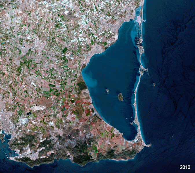
Using GEOSAT satellite High Resolution imagery, with a 600 km swath, the entire Mar Menor lagoon and much of the surrounding watershed can be captured in a single satellite pass. This capability offers several advantages:
- Complete spatial context: the lagoon and surrounding territory can be observed simultaneously.
- Consistent temporal monitoring: repeated acquisitions allow comparison across years.
- Efficient coverage: large environmental systems can be monitored without mosaicking multiple images.
With a historical archive spanning 2010–2025, these wide-area acquisitions create a valuable baseline for long-term environmental observation. Even when visible changes are subtle, the archive becomes critical for detecting future anomalies or shifts.
Very High-Resolution monitoring
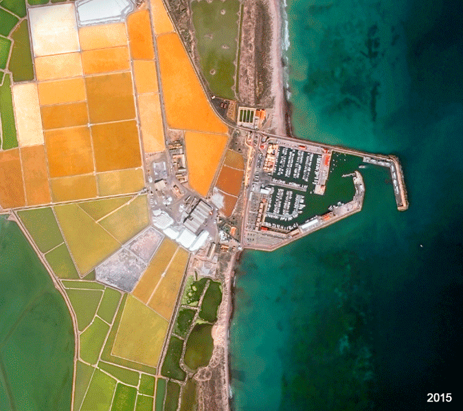
While wide swath imagery captures the broader environmental system, Very High-Resolution imagery allows detailed monitoring of specific areas of ecological interest.
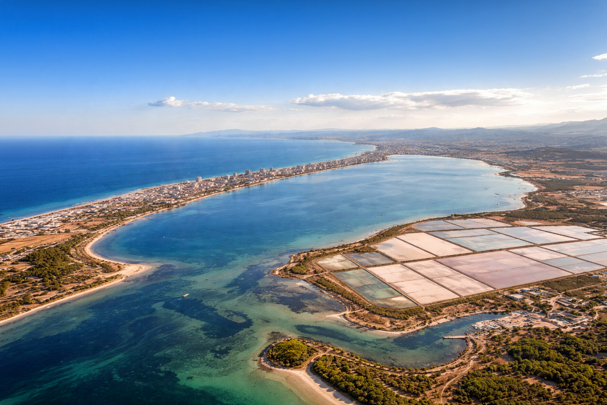
One example is the Parque Regional de las Salinas y Arenales de San Pedro del Pinatar, located at the northern edge of the lagoon. Very High-Resolution imagery enables:
- Detailed observation of coastal morphology and salt flats
- Monitoring of wetlands, lagoons and coastal vegetation
- Identification of infrastructure or land-use changes in sensitive environments
This combination of regional monitoring and local detail provides a powerful multi-scale perspective.
Long-Term and Multi-Scale Monitoring from Space
Environmental monitoring is not only about detecting dramatic change. It is also about building reliable baselines. A continuous archive of satellite imagery allows analysts to compare new acquisitions with historical conditions, detect gradual trends that may not be visible year to year, and support environmental assessments and scientific studies.
For ecosystems like the Mar Menor, where environmental conditions can change rapidly due to climatic or human factors, long-term Earth Observation archives become a critical monitoring asset.
Combining wide swath imagery and very high-resolution data enables a comprehensive monitoring strategy. Wide swath acquisitions provide the regional environmental context, capturing the entire lagoon and surrounding territory in a single pass, while very high-resolution imagery allows detailed analysis of key ecological areas such as the Parque Regional de las Salinas y Arenales de San Pedro del Pinata.
Together, these datasets create a scalable framework for monitoring complex coastal systems over time.
Long-term satellite archives and wide-area coverage also enable persistent observation of sensitive coastal environments. Beyond environmental protection, this capability can support maritime awareness, infrastructure monitoring, and the early detection of unusual activity in strategically important coastal zones.
Thanks to our own satellites, together with our partners, we deliver high quality imagery and analytics for high impact insights which result in improved decision making.