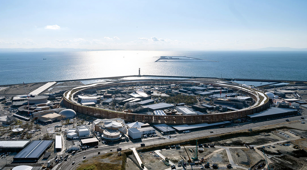
Expo Osaka 2025, which concludes on October 13, has been a showcase of innovation, culture, and sustainability. Since 2017, the area designated for the Expo has transformed from mostly empty land into a modern complex with pavilions, infrastructure, and public spaces designed to host millions of visitors. Satellite imagery makes it possible to follow each stage of this transformation and gain a better understanding of the scale of such a project.
Tracking the Transformation of Expo Osaka from Space
Urban development and megaprojects – Satellite images can help observe the evolution of large infrastructures from the first earthworks to completion. Analyzing the images year by year could reveal not only how construction progresses, but also the pace and sequence of the works, offering a unique perspective on urban change and how the Expo integrates with the surrounding city.
Impact monitoring and event preparation – Preparing a world-class event requires careful monitoring of environmental impact and land use. Satellites could help assess vegetation, coastal areas, and urban surroundings before, during, and after construction. This information may be useful to plan mitigations and ensure urban expansion does not compromise local ecosystems.
Sustainability and land use changes – Satellite imagery allows us to see how urban development affects the balance between built areas and green spaces, helping to track the creation of public areas and the management of natural resources. After the Expo concludes, these images could help measure the site’s territorial footprint and evaluate the project’s long-term sustainability.

Potential applications for planning and management – Beyond environmental analysis, satellite monitoring could be valuable for urban planners, insurers, and investment funds. It could allow independent verification of construction progress, reduce risks, and audit milestone compliance without field inspections, serving as a supportive tool for strategic decisions and large-scale project management.
The value of time-series imagery – Having images from 2017 to 2025 allows for context and the anticipation of future trends. Each image could provide temporal consistency, facilitating comparisons and deeper analyses beyond simple visual observation. Midway through the article, all available satellite images are presented, showing the full evolution of the site and offering a nearly decade-long visual journey.
Thanks to our own satellites, together with our partners, we deliver high quality imagery and analytics for high impact insights which result in improved decision making.