Most people who search for Nouadhibou online find the same thing: hundreds of rusting ships, abandoned in the shallow waters off the Mauritanian coast. For decades, the bay accumulated vessels from around the world; trawlers, cargo ships, naval cruisers, left to slowly dissolve into the landscape. At its peak, more than 300 wrecks lined the coastline. It became one of the most photographed ship graveyards on Earth.
That story is still out there. But if you point a satellite at Nouadhibou today, it tells a very different one.
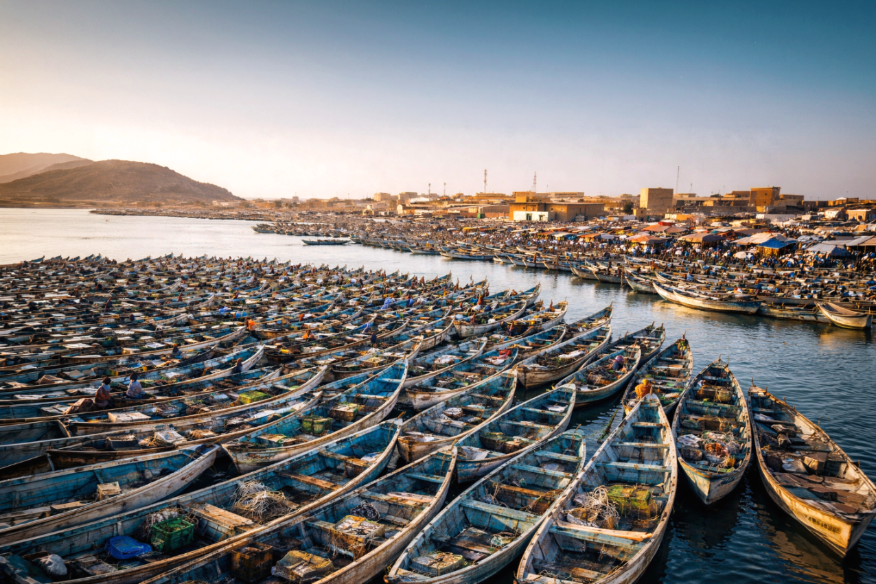
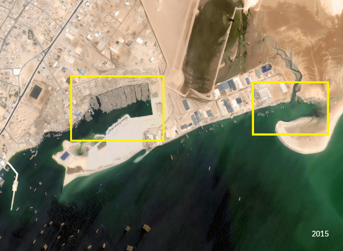
In 2015, the artisanal fishing port sits at the edge of the city — active, organized, but with room to breathe. Rows of pirogues, the long wooden fishing boats that are the backbone of West African small-scale fishing, line the docks in tight clusters. Water is still visible between them.
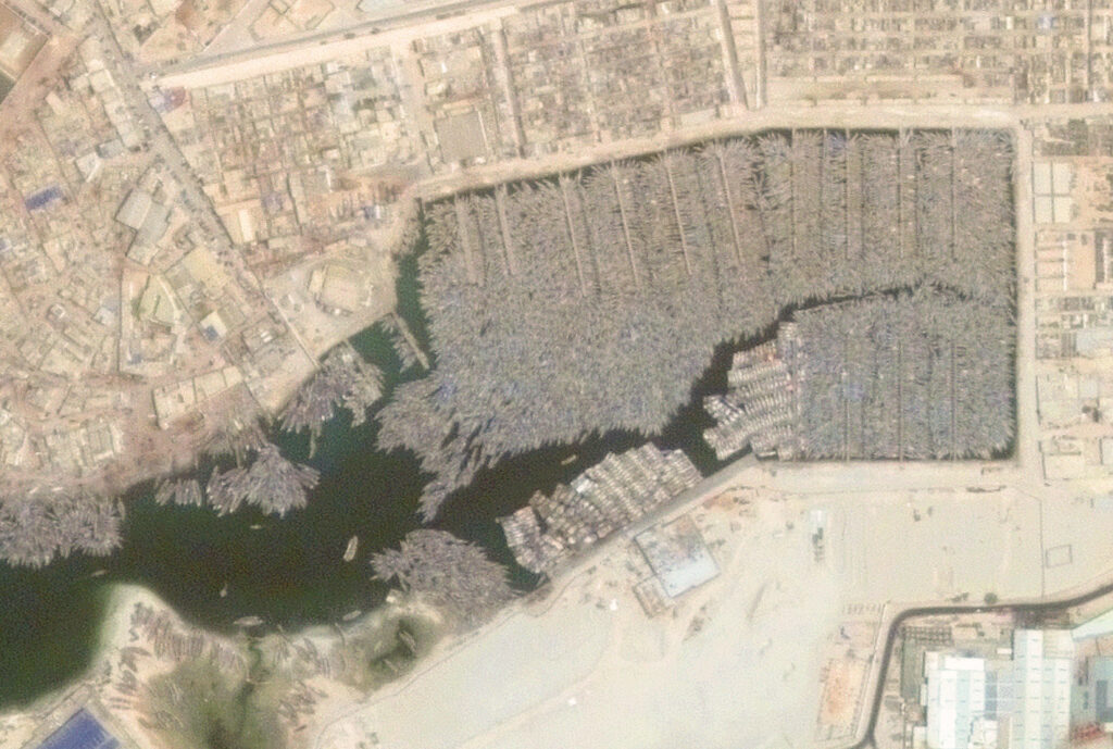
By 2020, the gaps have closed. The pirogues now form a near-continuous mass across the water. The port boundary; clear just five years earlier, has started to blur.
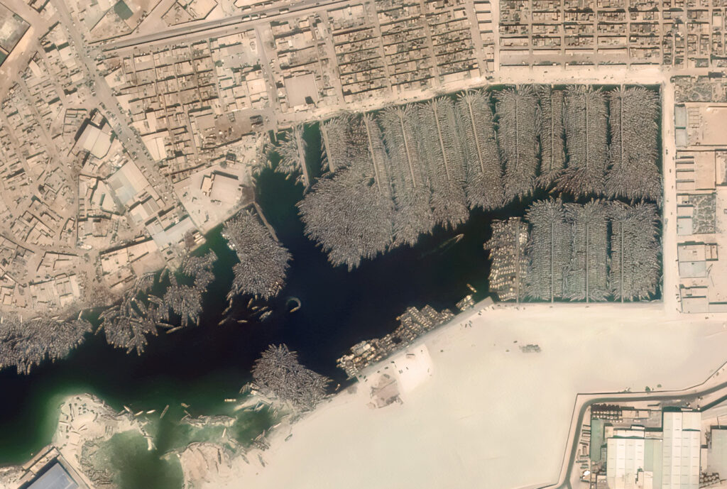
The 2025 image is the one that makes you stop. The boats have spilled beyond the original port perimeter entirely, colonizing areas that were open beaches a decade ago. New processing facilities and storage infrastructure have appeared at the southern edge. The city has grown around the port, visibly, in every direction.
The waters off Mauritania’s coast sit above one of the richest marine upwelling systems in the Atlantic, a cold current that pushes nutrients to the surface and sustains enormous fish populations. Octopus, sardines, demersal fish. The catch from this port moves through a growing processing industry and out to markets across Europe and Asia. The fishing sector today sustains hundreds of thousands of livelihoods across the country.
The rusting ships that made Nouadhibou famous are largely gone. What replaced them is harder to photograph from the ground — but unmistakable from space.
Thanks to our own satellites, we deliver high quality imagery and analytics for high impact insights which result in improved decision making.
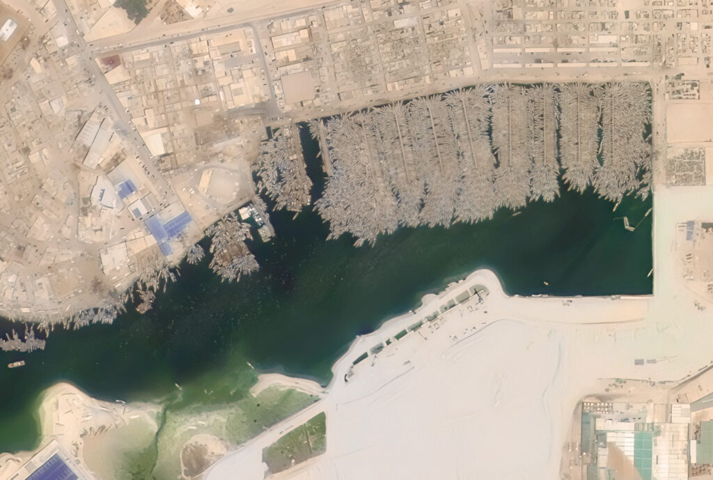
All satellite images: © GEOSAT. Very High-Resolution imagery acquired 2015, 2020, and 2025 over the Nouadhibou Artisanal Port, Mauritania
Thanks to our own satellites, together with our partners, we deliver high quality imagery and analytics for high impact insights which result in improved decision making.