Understanding the scope of the situation. An In-Depth analysis.
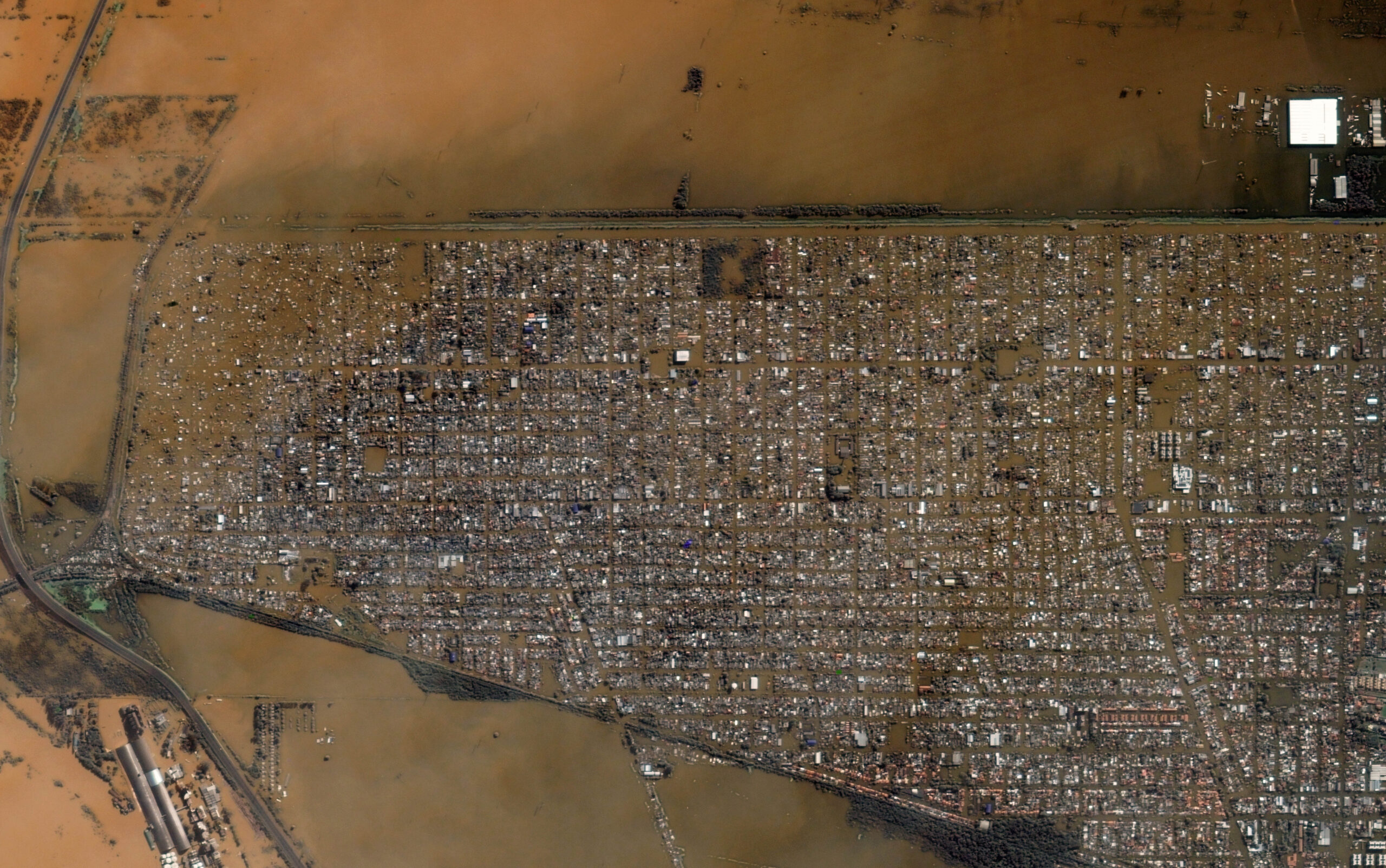
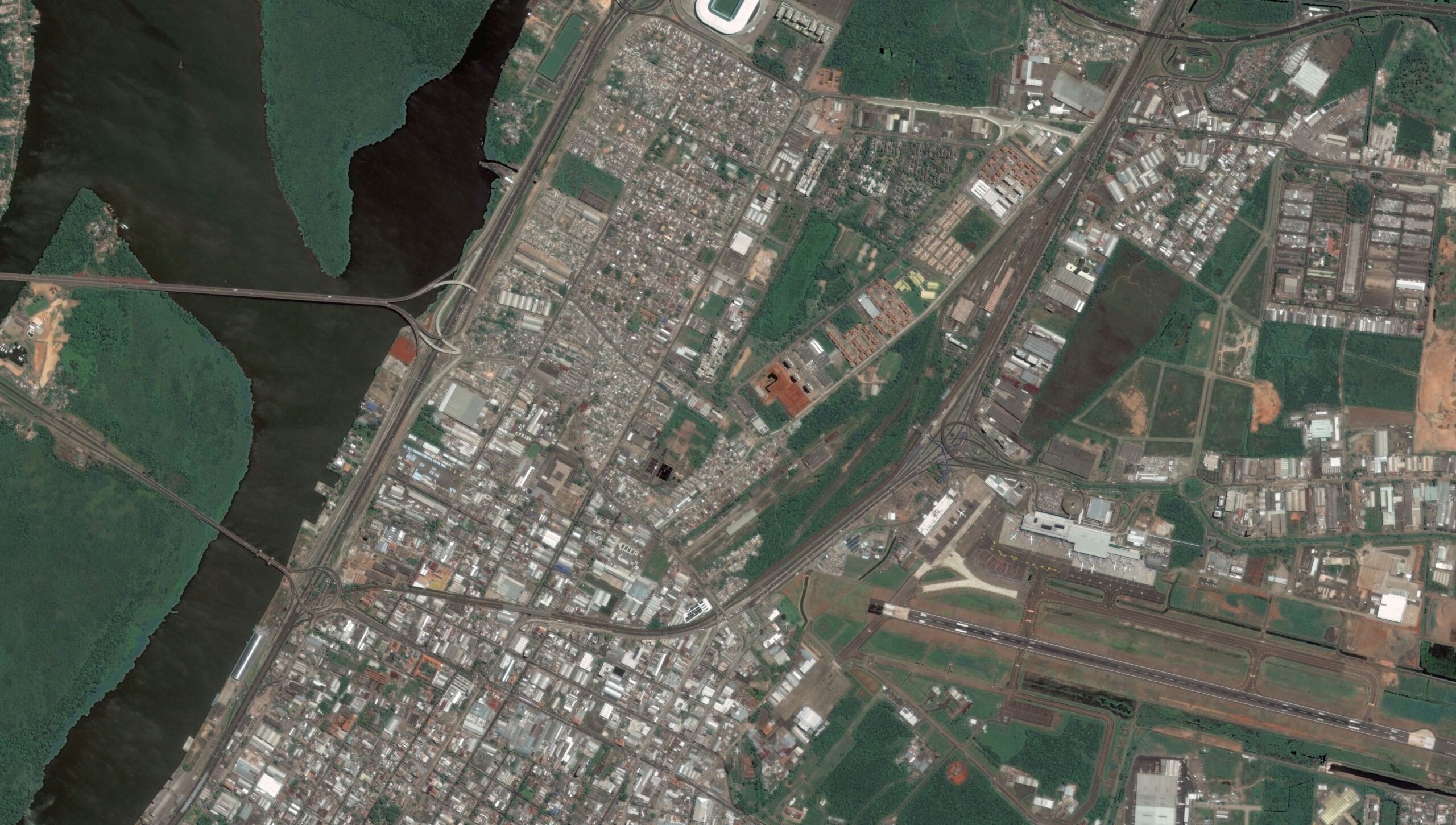
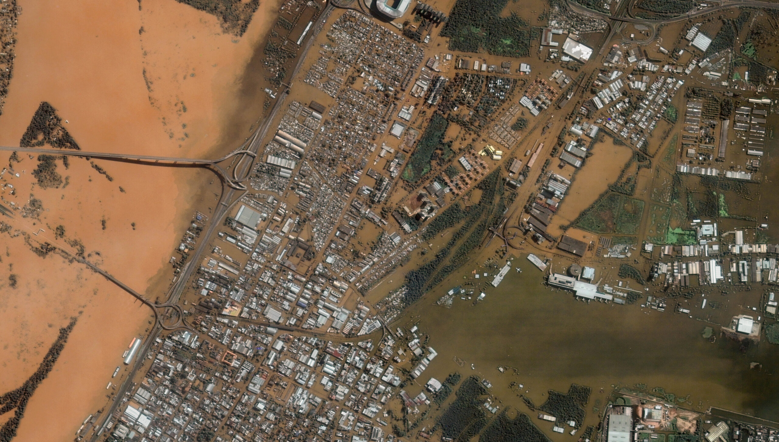
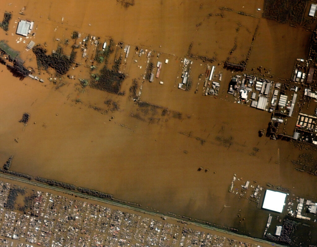
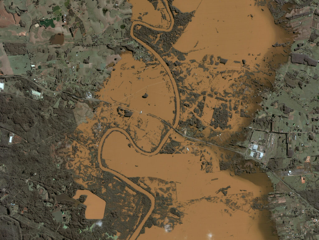
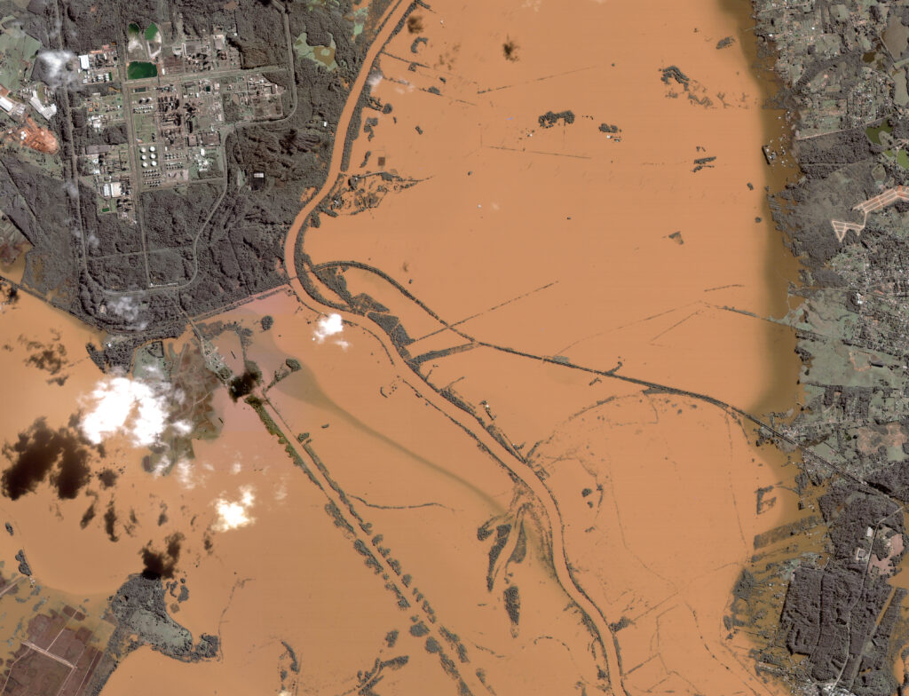
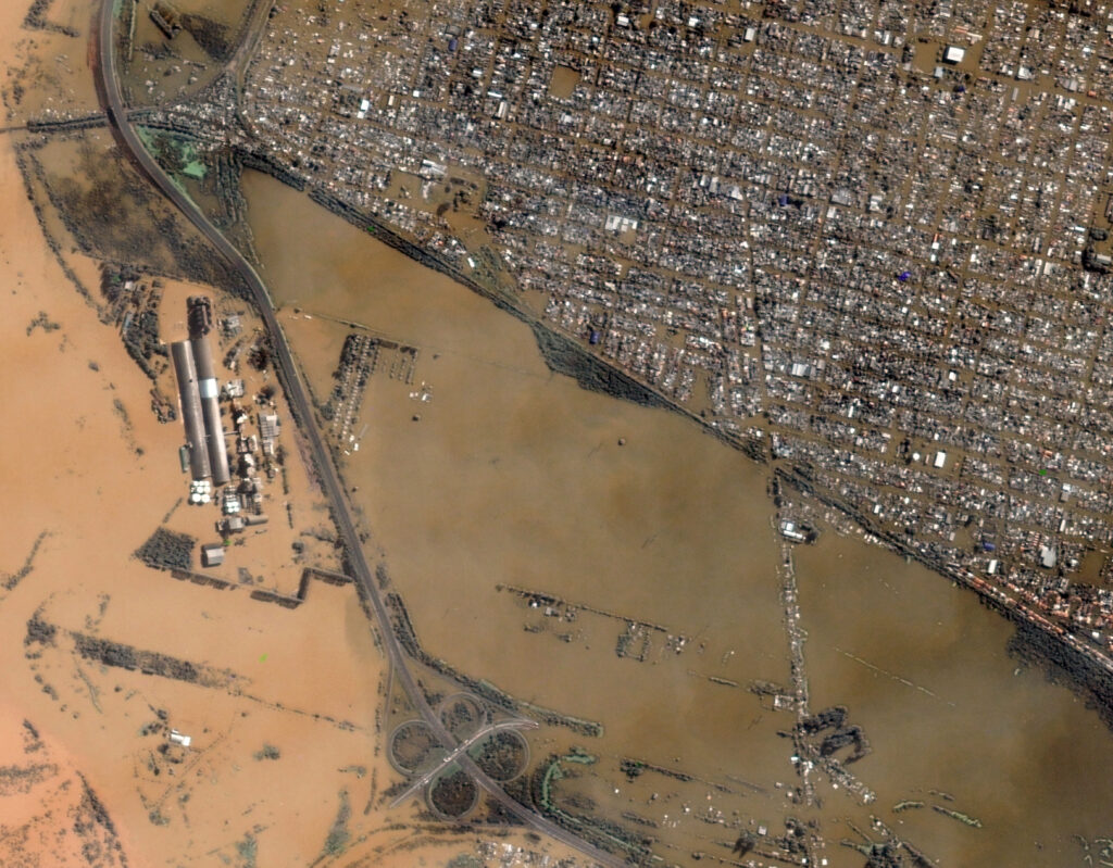
Heavy rains and floods hit southern Brazil last May, causing an emergency crisis in the state of Rio Grande Do Sul. More than 2.1 million people were affected by the floods, and more than 538.000 were displaced (according to some sources). The Guaíba River overflowed its banks and reached an all-time high of 5.31 meters, more than two meters above the overflow level. The floods caused destruction in cities and infrastructure.
GEOSAT tracked the evolution of the floods by mapping the extent of floodwaters, enabling rapid assessment and response during the emergency.
Improving Flood Crisis Management and accelerating the Recovery Process
Using GEOSAT’S satellite data in a flood crisis offers numerous advantages throughout the entire cycle and recovery process:
Enhanced People Safety: Our satellite data enables precise identification of impacted areas and the extent of damage, guiding the deployment of humanitarian aid to those in urgent need, optimizing the delivery of food, water, medical supplies, and shelter.
Damage Assessment: Post-flood, our Very-High-Resolution (VHR) satellite images accurately assess damage to infrastructure, homes, and the environment, guiding emergency response and recovery efforts.
Infrastructure Monitoring: Continuous monitoring of critical infrastructure, such as bridges and roads, helps identify damage and prioritize repairs.
Environmental Impact Assessment: Our satellite data assesses the environmental impact of the floods by segmenting affected ecosystems and habitats. This information is crucial for developing strategies to mitigate environmental damage and promote ecological recovery.
Historical Analysis: Archive data allows for the analysis of past flood events, improving future flood prediction models and urban planning to mitigate risks.
Enhanced Decision-Making: The detailed data and insights provided by GEOSAT supports better decision-making by authorities and stakeholders. It facilitates evidence-based strategies for rebuilding infrastructure, restoring ecosystems, and ensuring community resilience.
The scope of GEOSAT’s data for clients & insurers during flood crises
- Detailed Damage Assessments: We enable accurate evaluation of property damage.
- Rapid Claims Processing: We facilitate quicker and more efficient handling of insurance claims.
- Efficient Resource Allocation: We help you guide the prioritisation of response efforts and resource allocation.
- Quicker Recovery: We help fast-track recovery and support affected clients.
- Risk Evaluation: GEOSAT’s VHR imagery aids in assessing and understanding flood risks in great detail.
- Improved Preparedness: Our data help improve future flood preparedness and resilience strategies.
- Comprehensive Data: We provide a holistic view of the affected areas, aiding in coordinated response efforts.
By providing comprehensive, timely, and accurate information, GEOSAT’s satellite data helps improve humanitarian assistance, flood management, and recovery efforts, ultimately reducing the overall impact of flood crises. Our comprehensive approach ensures that the response to flood crises is effective, minimizing harm, primarily to people, and to the environment.
Thanks to our own satellites, together with our partners, we deliver high quality imagery and analytics for high impact insights which result in improved decision making.