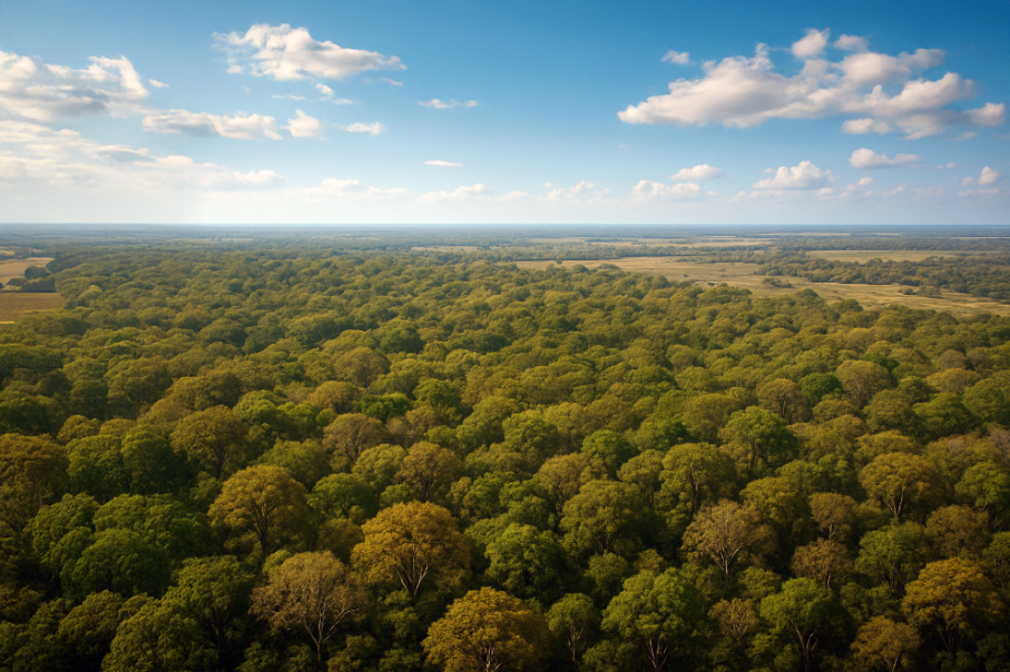
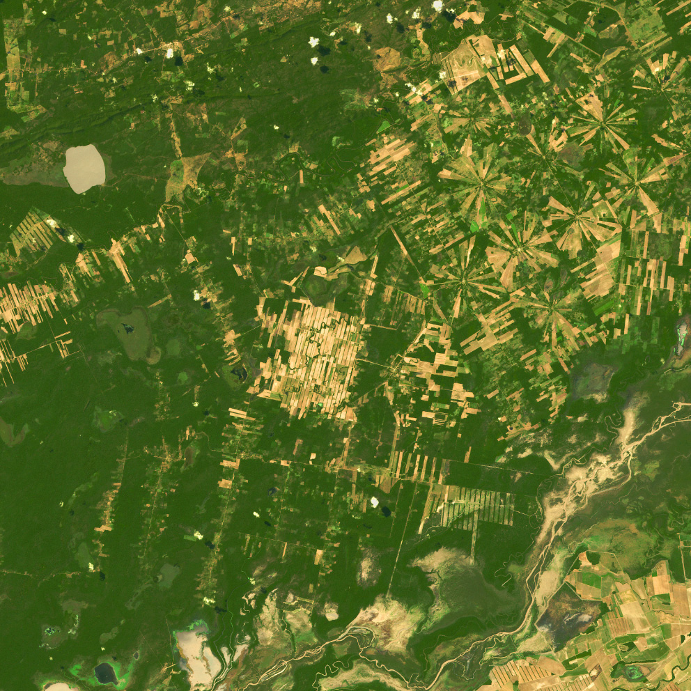
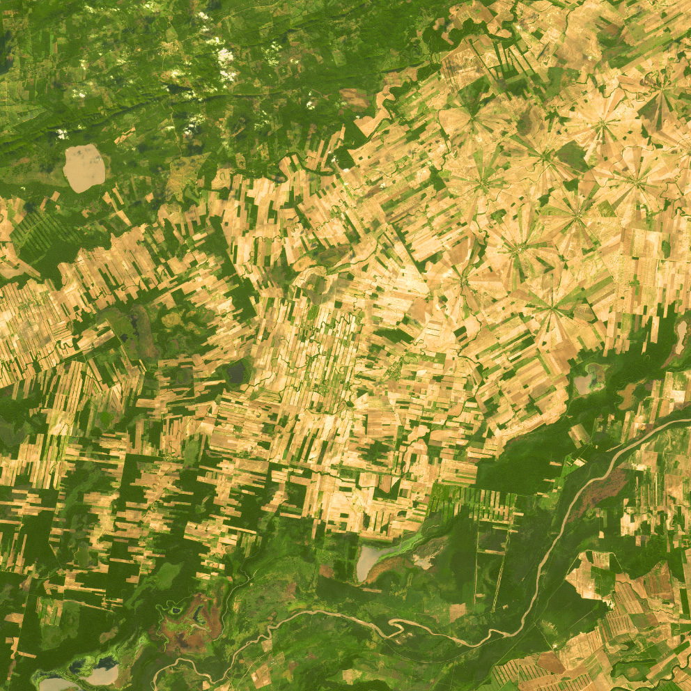
Stretching across eastern Bolivia, the Chiquitano Forest is one of the last remaining tropical dry forests in South America. Acting as a natural bridge between the Amazon, the Chaco, and the Brazilian Cerrado, it shelters an extraordinary diversity of species and communities that rely on its delicate balance.
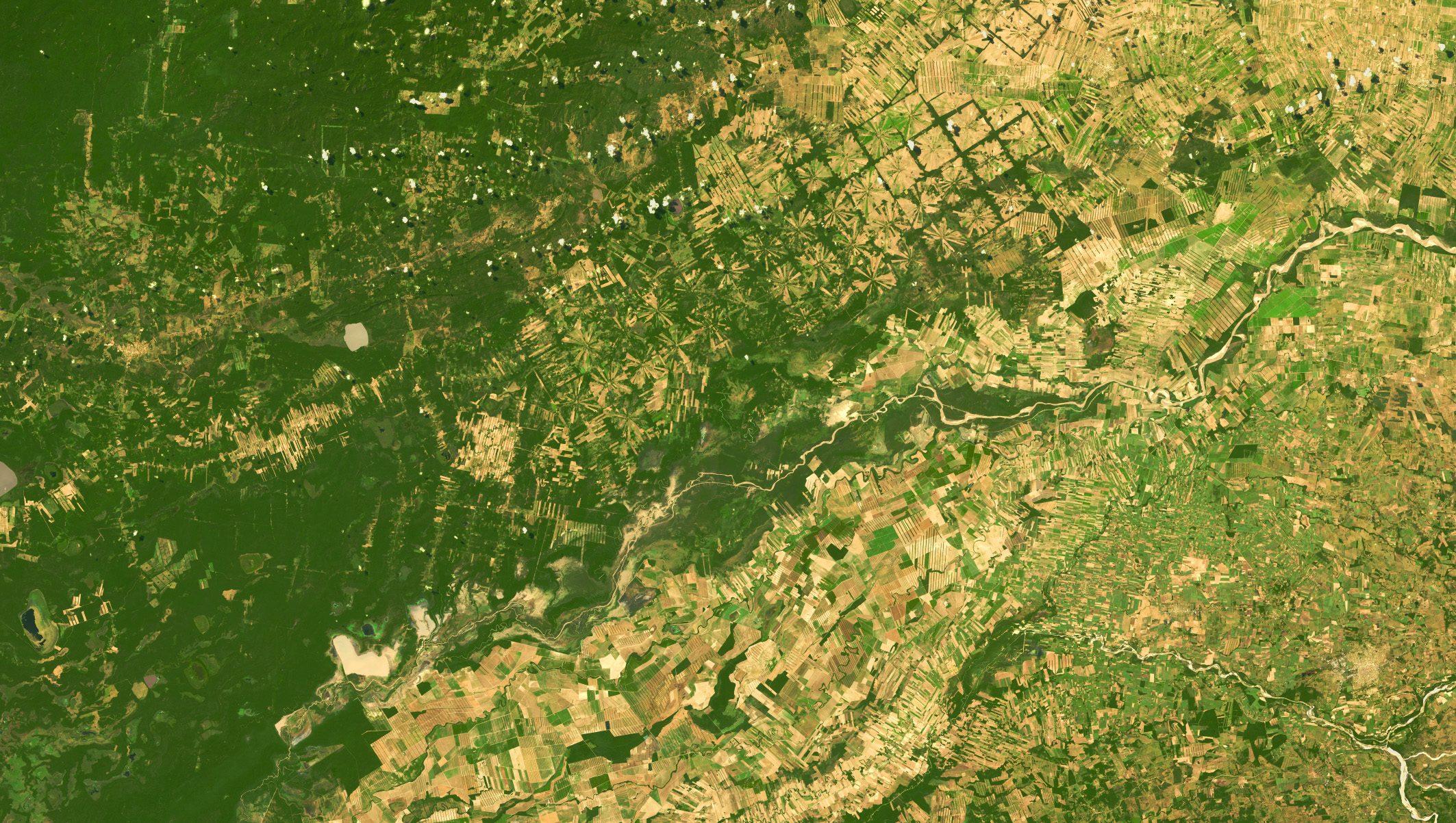
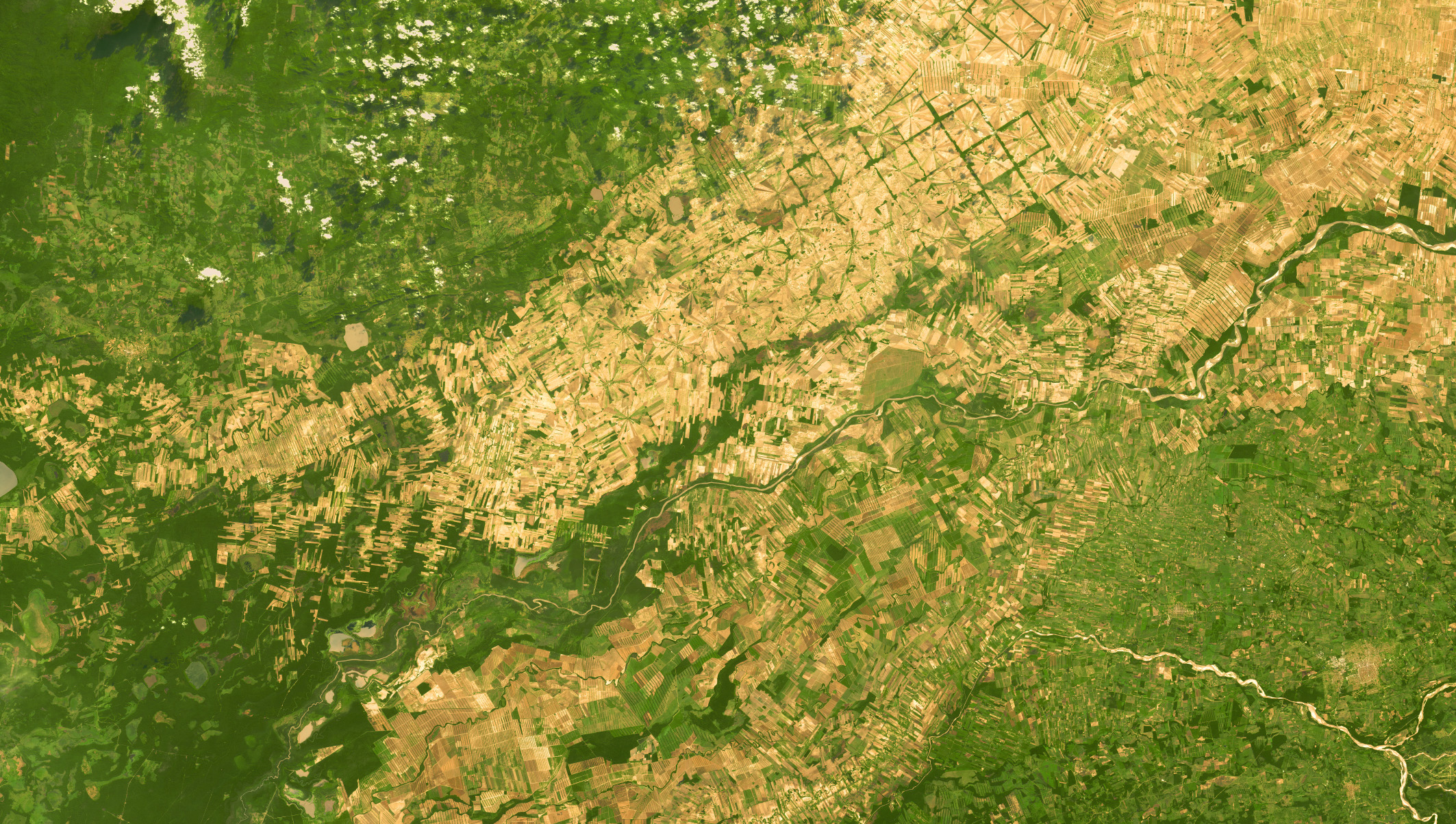
Since the late 1970s, the region has undergone continuous transformation. Expanding cattle ranching and agricultural activities have gradually reduced forest cover, reshaping the landscape in ways that are visible even from space. Still, a few small areas show signs of recovery—pockets of green returning where the land had been cleared a decade ago.
Monitoring Change from Space
To explore this evolution, we analyzed medium-resolution GEOSAT imagery from 2015 and 2025. With its wide swath coverage (up to 600 km), this type of satellite imagery is ideal for monitoring vast areas and detecting land-cover changes over time. The results clearly reveal how the landscape has shifted over the past ten years: deforestation remains predominant, yet patches of vegetation have begun to rebound.
These satellite observations not only document the challenges facing the Chiquitano Forest but also highlight ongoing local efforts to conserve and restore this unique ecosystem. Watching the region from above provides a broader perspective—one that helps us understand land dynamics and supports more balanced decisions between production and conservation.
Seeing the Chiquitano Forest through the lens of space reminds us that even small areas of regrowth matter. Each patch of green represents potential, and with continuous observation and informed action, there’s still room for a future where development and nature move forward together.
Thanks to our own satellites, together with our partners, we deliver high quality imagery and analytics for high impact insights which result in improved decision making.