On May 28, 2025, a massive landslide struck the village of Blatten, in the Lötschental Valley, canton of Valais, Switzerland. Triggered by the collapse of a portion of the Birch Glacier, the event buried large parts of the village under debris and temporarily blocked the Lonza River, creating a serious flood risk downstream.
Fortunately, the area had been evacuated days earlier, after early signs of slope instability were detected, preventing a greater tragedy. The landslide destroyed or severely damaged around 90% of local structures, altering the landscape of this Alpine valley.
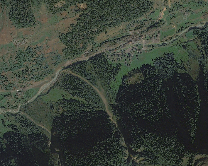
Seeing the transformation from above
Satellite imagery provides a clear perspective of how the terrain changed. GEOSAT captured two key moments of Blatten: September 2023, before the landslide. And August 2025, after the event.
The “before and after” comparison reveals visible transformations: a wide debris field, changes in river flow, and the loss of vegetation. The post-event image also highlights how sediments and materials reshaped the valley floor.
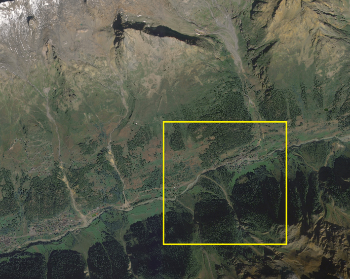
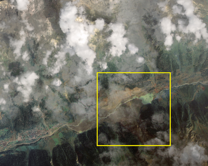
Before the landslide and after the event
Why consistent monitoring matters
Observing the same area over time — using archived imagery and new acquisitions — allows analysts to:
- Detect subtle and critical environmental changes
- Assess the extent and evolution of natural disasters
- Support decision-making in risk management, infrastructure protection, and environmental recovery
This case illustrates how Earth Observation contributes to faster and better-informed post-disaster assessments, helping authorities plan recovery and mitigation actions more effectively.

A closer view reveals the affected area before and after
A long-term perspective from space
From the quiet green slopes of 2023 to the disrupted terrain of 2025, Blatten’s story shows how satellite archives hold immense value. Continuous monitoring ensures that every change, gradual or sudden, can be tracked, understood, and addressed with data-driven precision to the intelligent harnessing of solar energy.
Thanks to our own satellites, together with our partners, we deliver high quality imagery and analytics for high impact insights which result in improved decision making.